Peri Urban Structure Plan of Okara City

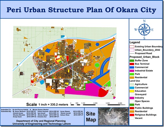
A group of urban planning students from University of Engineering and Technology (CRP-10) including M. Aamir Basheer, Imtiaz Hussain, Imran Nawaz, Zohaib Anwar, Iqra Ismail, Rohail Javaid, Ghulam Mustafa, Akram Anwar, Adnan Khan, Aniqa Azam, Areesha Gul has prepared GIS based peri urban structure plan of Okara City using high resolution satellite image. The map includes Points of interest , Existing urban boundary , Existing land uses, Proposed Roads, and Proposed urban block.

This is a true addition to the existing effort on GIS mapping of Okara which was done by Munawar and Nausheen (CRP-08) in 2009. Previous map can be seen HERE.

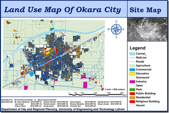
Okara file

Prei Uran final image

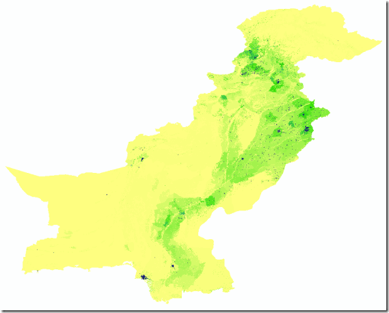
High resolution data on human population distributions in Pakistan

High resolution, contemporary data on human population distributions are a prerequisite for the accurate measurement of the impacts of population growth, for monitoring changes and for planning interventions. The AsiaPop project was initiated in July 2011 with an aim of producing detailed and freely-available population distribution maps for the whole of Asia. This appears to be the highest resolution data on the subject available in open source as of today.

image6078

Details

Units: Persons per grid square

Projection: Geographic (WGS84)

Spatial Resolution: 0.000833 degrees (~100m at the equator)

Years: 2010, 2015

Versions: (i) Adjusted to match UN national estimates and (ii) Unadjusted

Format: Geotiff (zipped using 7-zip (open access tool)

Pakistan Soil Data based on Shear wave Velocity of 30 meters

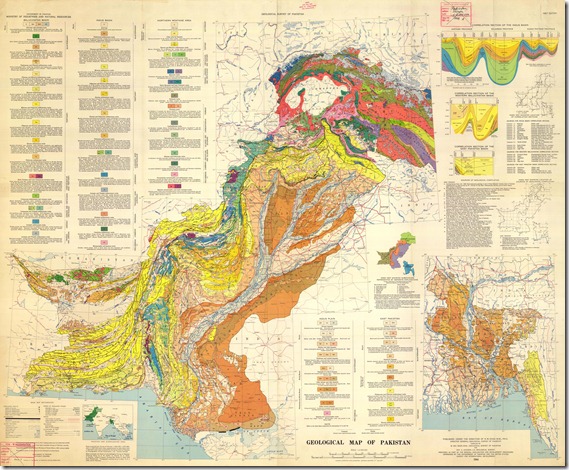
Here is the raster soil layer for the soils based on shear wave velocity of 30 meters.

Vs30 measurements (the average shear-velocity down to 30 m) are correlated against topographic slope to develop two sets of coefficients for deriving Vs30: one for active tectonic regions that possess dynamic topographic relief, and one for stable continental regions where changes in topography are more subdued.  The soil layers that are generated were based on Active Tectonic values.

Read a detailed research paper on the subject:

image

For more information check out the USGS Global Vs30 Map Server: http://earthquake.usgs.gov/hazards/apps/vs30/

Airline Route Mapper

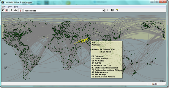
Airline Route Mapper is a Windows program for exploring route maps of over 550 airlines. You can search by airports or airlines.

imageimage

Originally available at http://arm.64hosts.com/

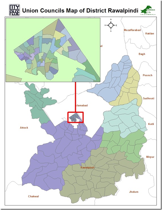
Union Council Boundaries of Rawalpindi City and District

This GIS datasets contains polygonal boundaries for 170 union councils of Rawalpindi urban area as well as Rawalpindi District. This geo-dataset is more reliable for urban area and seems to be less accurate for rural towns.

Rawalpindi UCs Pakistan GIS

.::Click HERE to request for this data set::.

Vector Datasets (ESRI Shapefiles)

Currently following vector datasets are available in ESRI Shape files Format at this blog:

Administrative Boundaries Maps:

  1. National and Provincial Boundaries of Pakistan (Admin Level 0 and 1)
  2. District Boundaries of Pakistan (Admin Level 2)
  3. Tehsil Boundaries of Pakistan (Admin Level 3)
  4. Union Council Map (Admin level 4) of District Barkhan – Balochistan
  5. Union Council Map (Admin level 4) of District Jaffarabad – Balochistan

  6. Union Council Map (Admin level 4) of District Killa Saifullah – Balochistan

  7. Union Council Map (Admin level 4) of District Kohlu – Balochistan

  8. Union Council Map (Admin level 4) of District Loralai – Balochistan

  9. Union Council Map (Admin level 4) of District Nasirabad – Balochistan

  10. Union Council Map (Admin level 4) of District Sibi – Balochistan

Khyber Pakhtunkhwa

  1. Union Council Map (Admin level 4) of District Abbottabad – KPK

  2. Union Council Map (Admin level 4) of District Bannu – KPK

  3. Union Council Map (Admin level 4) of District Batagram – KPK

  4. Union Council Map (Admin level 4) of District Buner – KPK

  5. Union Council Map (Admin level 4) of District Charsadda – KPK

  6. Union Council Map (Admin level 4) of District Chitral – KPK

  7. Union Council Map (Admin level 4) of District Dera Ismail Khan – KPK

  8. Union Council Map (Admin level 4) of District Hangu – KPK

  9. Union Council Map (Admin level 4) of District Haripur – KPK

  10. Union Council Map (Admin level 4) of District Karak – KPK

  11. Union Council Map (Admin level 4) of District Kohat – KPK

  12. Union Council Map (Admin level 4) of District Kohistan – KPK

  13. Union Council Map (Admin level 4) of District Lakki Marwat – KPK

  14. Union Council Map (Admin level 4) of District Lower Dir – KPK

  15. Union Council Map (Admin level 4) of District Malakand P.a. – KPK

  16. Union Council Map (Admin level 4) of District Mansehra – KPK

  17. Union Council Map (Admin level 4) of District Mardan – KPK

  18. Union Council Map (Admin level 4) of District Nowshera – KPK

  19. Union Council Map (Admin level 4) of District Peshawar – KPK

  20. Union Council Map (Admin level 4) of District Shangla – KPK

  21. Union Council Map (Admin level 4) of District Swabi – KPK

  22. Union Council Map (Admin level 4) of District Swat – KPK

  23. Union Council Map (Admin level 4) of District Tank – KPK

  24. Union Council Map (Admin level 4) of District Upper Dir – KPK

Punjab

  1. Union Council Map (Admin level 4) of District Bahawalpur – Punjab

  2. Union Council Map (Admin level 4) of District Bhakkar – Punjab

  3. Union Council Map (Admin level 4) of District Dera Ghazi Khan – Punjab

  4. Union Council Map (Admin level 4) of District Jhang – Punjab

  5. Union Council Map (Admin level 4) of District Khushab – Punjab

  6. Union Council Map (Admin level 4) of District Layyah – Punjab

  7. Union Council Map (Admin level 4) of District Mianwali – Punjab

  8. Union Council Map (Admin level 4) of District Multan – Punjab

  9. Union Council Map (Admin level 4) of District Muzaffargarh – Punjab

  10. Union Council Map (Admin level 4) of District Rahim Yar Khan – Punjab

  11. Union Council Map (Admin level 4) of District Rajanpur – Punjab

Sindh

  1. Union Council Map (Admin level 4) of District Dadu – Sindh

  2. Union Council Map (Admin level 4) of District Ghotki – Sindh

  3. Union Council Map (Admin level 4) of District Hyderabad – Sindh

  4. Union Council Map (Admin level 4) of District Jacobabad – Sindh

  5. Union Council Map (Admin level 4) of District Jamshoro – Sindh

  6. Union Council Map (Admin level 4) of District Kashmore – Sindh

  7. Union Council Map (Admin level 4) of District Khairpur – Sindh

  8. Union Council Map (Admin level 4) of District Larkana – Sindh

  9. Union Council Map (Admin level 4) of District Matiari – Sindh

  10. Union Council Map (Admin level 4) of District Naushahro Feroze – Sindh

  11. Union Council Map (Admin level 4) of District Qambar Shahdadkot – Sindh

  12. Union Council Map (Admin level 4) of District Shaheed Benazirabad – Sindh

  13. Union Council Map (Admin level 4) of District Shikarpur – Sindh

  14. Union Council Map (Admin level 4) of District Sukkur – Sindh

  15. Union Council Map (Admin level 4) of District Tando Muhammad Khan – Sindh

  16. Union Council Map (Admin level 4) of District Thatta – Sindh

Urban Union Councils:

Urban Area Maps:

  1. Haripur GIS Map (ESRI Format)
  2. Peshawar GIS Map (ESRI Format)
  3. Mianwali Tehsil GIS Map (ESRI Format)
  4. Quetta GIS Map (ESRI Format)
  5. Gilgit GIS Map (ESRI Format)
  6. Nankana Sahib GIS Map (ESRI Format)
  7. Jaranwala GIS Map (ESRI Format)
  8. Pindi Bhattian GIS Map  (ESRI Format)
  9. Khangah Dogran GIS Map (ESRI Format)
  10. Chiniot GIS Map (ESRI Format)
  11. Chakwal GIS Map (ESRI Format)
  12. Attock GIS based Land use Map (ESRI Format)
  13. Faisalabad GIS based Land use Map (ESRI Format)
  14. Village Kesar Garh (District Kasur) GIS Based Landuse Map (ESRI Format)

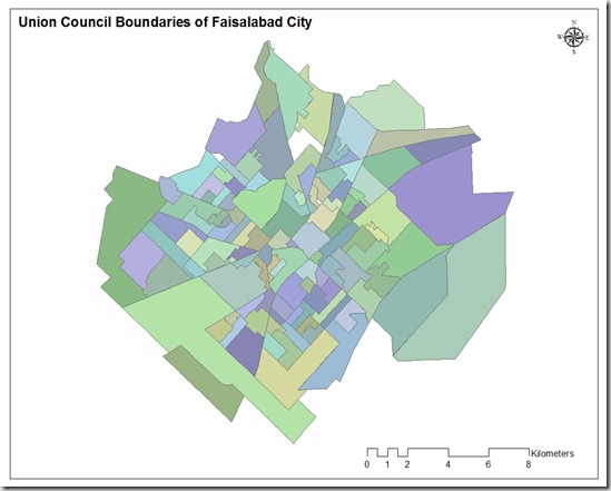
Union Council Boundaries of Faisalabad City

This GIS map consists of polygonal boundaries for 118 union councils of Faisalabad urban area. It has been developed and generously shared by Nasar min Allah Bhalli (M.Phil) from  Department of geography, GC University Faisalabad.

Union council boundaries of faisalabad

                                   .::Click HERE to request for this data set::.

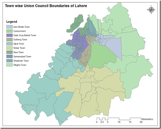
Town wise Union Council Boundaries of Lahore

This GIS map consists of polygonal boundaries for 151 union councils of Lahore urban area divided in 11 Towns.

Union council boundaries of lahore

Special thank to our very Valued Contributor for Lahore.

                                   .::Click HERE to request for this data set::.