Census of Schools with GIS Coordinates

  1. Punjab

It is lovely to see the Census of Schools conducted by Schools Education Department, Government of Punjab. The online database contains very comprehensive information for more than 55 thousand educational facilities in all districts of Punjab along with locational information.

image

Below image shows, how it looks like when plotted in GIS all together at once. Only a few schools (less than 3%) have got missing GIS coordinates or wrongly placed coordinates, but overall it’s a very comprehensive and rich piece of information for those interested in education sector in Punjab.

image

2.  Sindh

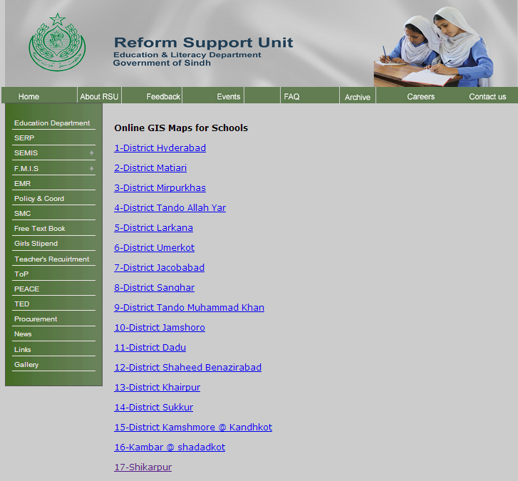
Reform Support Unit, Education and Literacy Department, Government of Sindh has also done a great job by providing online access to School Census Database and Online GIS coordinates of schools from 17 districts. So far, these districts include Hyderabad, Matiari, Mirpurkhas, Tando Allah Yar, Larkana, Umerkot, Jacobabad, Sanghar, Tando Muhammad Khan, Jamshoro, Dadu, and Shaheed Benazirabad, Khairpur, Sakkur, Kashmore, Shahdadkot and Shikarpur.

sindh_schools_gis_pakistan

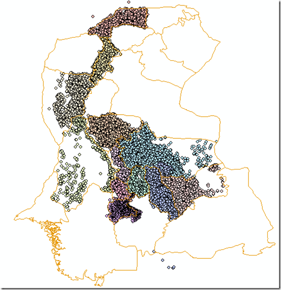
Currently the online database contain coordinates of more than 28 Thousand as of July 2014 educational facilities spreaded over 17 districts. This is how it looks like all together.

image

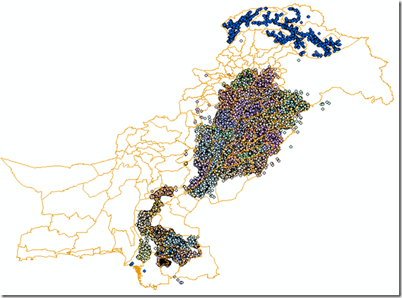
Overall picture look like the image below:

image

Airline Route Mapper

Airline Route Mapper is a Windows program for exploring route maps of over 550 airlines. You can search by airports or airlines.

imageimage

Originally available at http://arm.64hosts.com/

Union Council Boundaries of Rawalpindi City and District

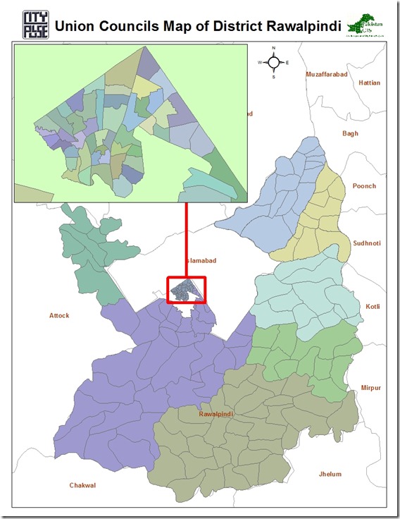
This GIS datasets contains polygonal boundaries for 170 union councils of Rawalpindi urban area as well as Rawalpindi District. This geo-dataset is more reliable for urban area and seems to be less accurate for rural towns.

Rawalpindi UCs Pakistan GIS

.::Click HERE to request for this data set::.

Union Council Boundaries of Faisalabad City

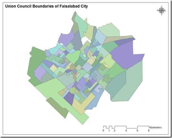
This GIS map consists of polygonal boundaries for 118 union councils of Faisalabad urban area. It has been developed and generously shared by Nasar min Allah Bhalli (M.Phil) from  Department of geography, GC University Faisalabad.

Union council boundaries of faisalabad

                                   .::Click HERE to request for this data set::.

Town wise Union Council Boundaries of Lahore

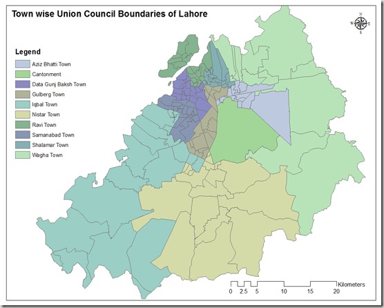
This GIS map consists of polygonal boundaries for 151 union councils of Lahore urban area divided in 11 Towns.

Union council boundaries of lahore

Special thank to our very Valued Contributor for Lahore.

                                   .::Click HERE to request for this data set::.

Land Capability Map of Punjab

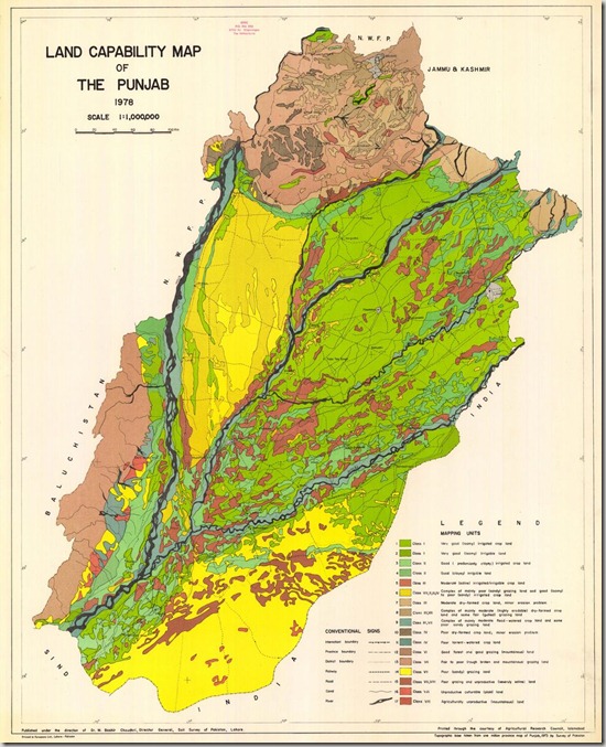
landcapability map of punjab

Title:
Land Capability Map of the Punjab.

Publication year:
1978

Publisher(s):
Direction of Dt. M. Bashir Choudhri. Director General. Soil Survey of Pakistan.

Language:
En

Coordinates:
N34°0 – N27°50 °10 – E75°10

Scale:
1,000,000

Karachi Town Administration Boundaries

This GIS map contains polygonal boundaries for 31 administration town of Karachi. It has been developed by Dr. Jamil H. Kazmi at he Department of geography, University of Karachi and generously shared by Bilal Aslam (Research Fellow).

Karachi_town_boundaries

Street Level GIS Map of Bahawalnagar

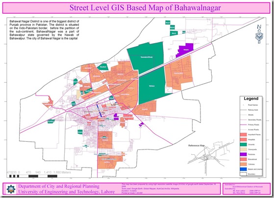
Bahawalnagar is a city and tehsil of Bahawalnagar District in the Punjab province of Pakistan[1] and lies just south of the Sutlej River, its population according to the 1998 census of Pakistan was 2,061,000[2]. Read More>>
This map has been been prepared by Hina Munir and Amir Safdar. They are Urban Planners from Department of City & Regional Planning, University of Engineering & Technology, Lahore.

Methodology Adopted:

Street level mapping has been completed using high resolution images (0.6-1m) of  Google Earth dating October 26, 2009. Detailed process is mentioned in the tutorial HERE.

Contents:
  1. Data Layers:
  • Primary Roads
  • Secondary Roads
  • Tertiary Roads/ Streets
  • Water Bodies
  • Railway Lines
  • Points of Interest (Hospitals, Educational Buildings, Public Buildings, Mosques, Hotels, Banks, Petrol Pumps etc)
  • Area features (Parks, open spaces, Built up areas, Graveyards, Housing Schemes, water bodies etc)

   2.    Coverage:

  • 77.45 Square Kilometer

Bahawalnagar

Availability:

Data is available in KML and ESRI Shape file formats.

Get Data:
If you want to acquire this data, Use the Request Data Form to share your research and need of this data.

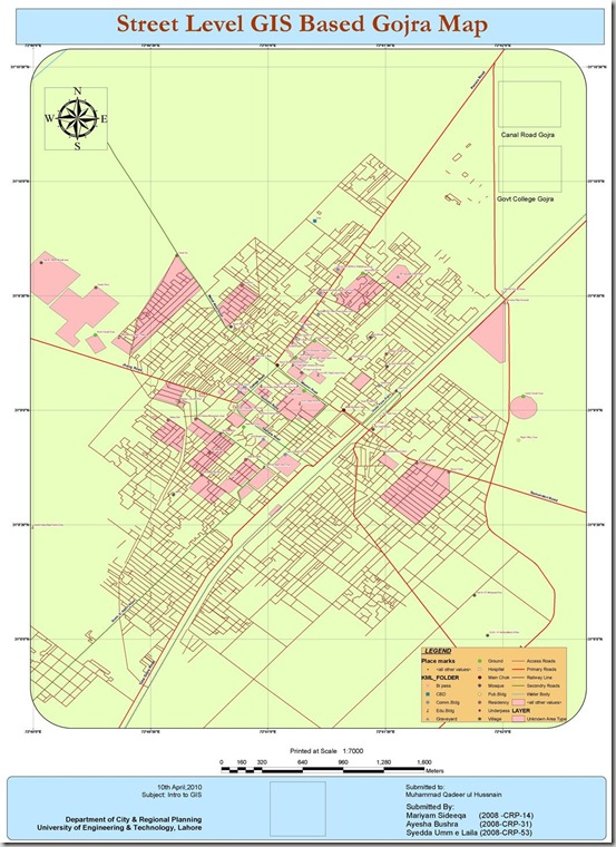
Street Level GIS Map of Gojra

Gojra (Punjabi, Urdu: گوجرہ), the capital of Gojra Tehsil, is a city of Toba Tek Singh District in the Punjab province of Pakistan,[1] it is located at 31°9’N 72°41’E[2] and is located 30 miles (50 km) from Faisalabad, 125 km from Burewala, 157 km from Vehari and 20 miles (32 km) north of Toba Tek Singh.[3] It has a history of more than hundred years, and being the centre of the cultivated lands, the village was famous for its “Mandi” (market) for cash crops. Before the 1947 Partition of India that created Pakistan the “Mandi” was mainly handled by Hindus and Sikhs. Read More>>
This map has been been prepared by Mariyam, Aysha and Syedda Umme Laila. They are Urban Planners from Department of City & Regional Planning, University of Engineering & Technology, Lahore.

Methodology Adopted:

Street level mapping has been completed using high resolution images (0.6-1m) of  Google Earth dating May 20, 2009 within a period of two months. Detailed process is mentioned in the tutorial HERE.

Contents:
  1. Data Layers:
  • Primary Roads
  • Secondary Roads
  • Tertiary Roads/ Streets
  • Water Bodies
  • Railway Lines
  • Points of Interest (Hospitals, Educational Buildings, Public Buildings, Mosques, Hotels, Banks, Petrol Pumps etc)
  • Area features (Parks, open spaces, Built up areas, Graveyards, Housing Schemes, water bodies etc)

   2.    Coverage:

  • 46.58 Square Kilometer

Gojra map2

Availability:

Data is available in KML and ESRI Shape file formats.

Get Data:
If you want to acquire this data, Use the Request Data Form to share your research and need of this data.