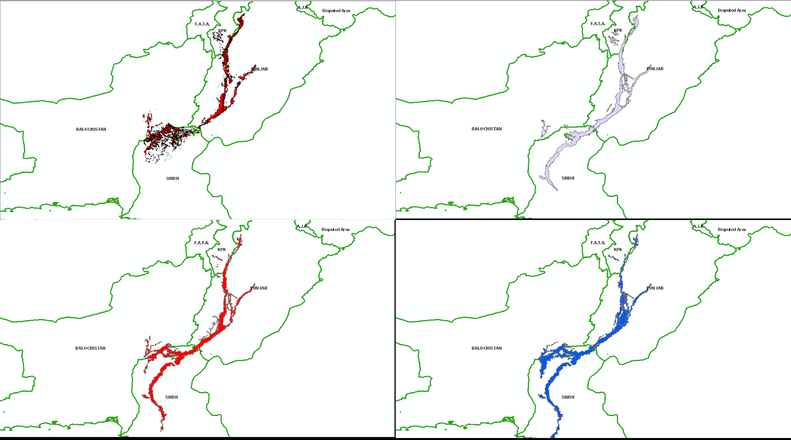
Pakistan Flood 2010, Water Extent from MODIS 12-29 Aug 2010

This geo-database is an effort of Mountain GeoPortal ICIMOD and includes the shapefiles of Water extent of 2010 flood in Pakistan. The flood water extent have been calculated from MODIS Images dating 12 August 2010 to 29 Aug 2010 on daily basis.

Pak Flood Extent 12-29 Aug 2010

                                          .::Click HERE to request for this data set::.

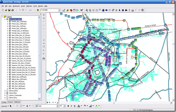
GIS Map of Bus Routes in Lahore

Mirza Muhammad Waqar form University of the Punjab is working on a project related to GIS mapping of various public transport routes in Lahore. He has generously shared his field data collected through primary surveys using GPS device. It includes the Bus Route Lines and Bus Stops Locations.

The GIS layers include the following routes:

  1. ABC Bus Route 36 (Chungi Amar Sadu to Daroghawala)
  2. ABC Bus Route 44 (Daroghawala to Old Ravi Pull)
  3. Baloch Bus Service Route 20 (Old Ravi Pull to Bagrian)
  4. Bashir Hussain Bus Route 21
  5. Bashir Hussain Bus Route 43
  6. Daewoo City Bus Route 11 (Green Town to Station)
  7. Green City Bus Route 10 (Railway Station to NFC Housing Scheme)
  8. New Khan Bus Route 3
  9. New Khan Bus Route 4
  10. New Khan Bus Route 1 (Sanda to RZ Bazar)
  11. New Khan Bus Route 17 (Railway Station to Jallo Pind)
  12. New Khan Bus Route 22 (Jallo Mor to Thokar Niaz Beig)
  13. Premier Bus Route 12-A (Railway Station to Yohanabad)
  14. Premier Bus Route 14 (RA Bazar to Bagrian)
  15. Premier Bus Route 19

image

Availability:

Data is available in ESRI Shape file formats.

Get Data:
If you want to acquire this data, Use the Request Data Form to share your research and need of this data.
 
Since this data belongs to Waqar, we will take his prior permission before disseminating this data set.

Data Request Form

Dear visitor, thanks for your interest. We are getting increased number of request for variety of datasets of various formats every day. Please use the form below to get the right data for your research by providing us the specific information in a structured way.

Note:

  1. All data at PakGIS is available for your if you are academic researcher or doing some project for the betterment of Pakistani society.
  2. We don’t provide data just for using in study assignments or otherwise unless you promise to create some new data sets associated or up grade the existing data (geometry or attributes).
  3. We believe in joining hands for building new datasets for Pakistan, if we share our costly datasets, we ask you as well to send at least one additional set of information back at PakGIS.
  4. We try our best to reply you back in shortest possible time, generally it takes one or two days. If you don’t get any response, kindly ensure that your data request has been sent properly or resend it.
  5. If you want to get any data set for the purpose of learning GIS, its better to contact us with straight objective. We have better options for you. We can guide you through various steps of GIS development, tools and techniques and necessary procedures in the simplest possible way.


                        <>