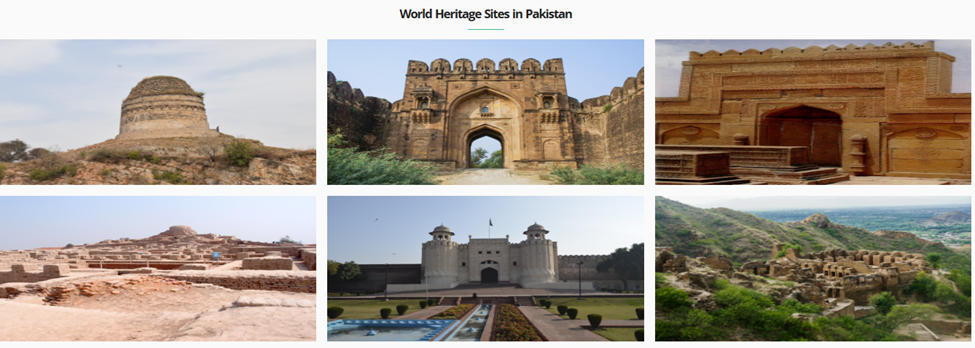
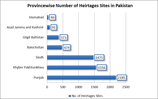
With more than 6,000 heritage sites, Pakistan is a country rich in cultural, historical, and archaeological landmarks such as Mohenjo-Daro, Taxila, and the Lahore Fort.

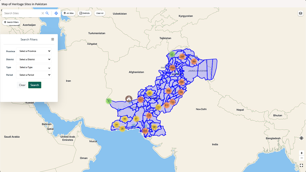
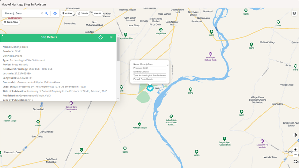
Mapping heritage sites in Pakistan accurately using GIS can facilitate better management, protection, and promotion of the nation’s heritage. It enables authorities to monitor changes in site conditions, assess vulnerabilities to natural and anthropogenic threats like urban expansion or climate impacts, and plan conservation measures effectively. Therefore, Department of Archaeology and Museums, Government of Pakistan has launched and published an online map of the significant heritage sties across all the provinces of Pakistan.
The user can apply filters of Province, district, type and period as well as search the complete heritage sites repository on basis of the site name. On a single click, the user can get detailed information about the site including name, province, district, geographic coordinates, period, relative chronology, description, legal status, year of publication, and bibliographic reference etc.
GIS also allows integration of visitor data to analyze seasonal trends in tourism, identifying peak and low visitation periods. The presently available visitor record at archeological museums in Pakistan during January to December from 2015 to 2021, published by Pakistan Bureau of Statistics, Government of Pakistan can be geotagged and analyzed. This would help in optimizing visitor management, ensuring that infrastructure and resources are aligned with demand, and enhancing the visitor experience while mitigating over-tourism risks. By leveraging GIS for such purposes, Pakistan can preserve its heritage for future generations while promoting sustainable tourism.