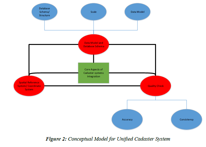
The Specification Document for the Unified Cadastral System Model is now available on the PakistanGIS GeoNode Platform.
Developed and released by Survey of Pakistan, this document provides a standardized framework for reforming and modernizing the cadastral system of Pakistan. The sample model has been built within the ArcGIS environment.
What’s Inside?
Clear definitions of key cadastral components & layers
Guidelines for data collection, storage, sharing & maintenance
Metadata standards aligned with international best practices
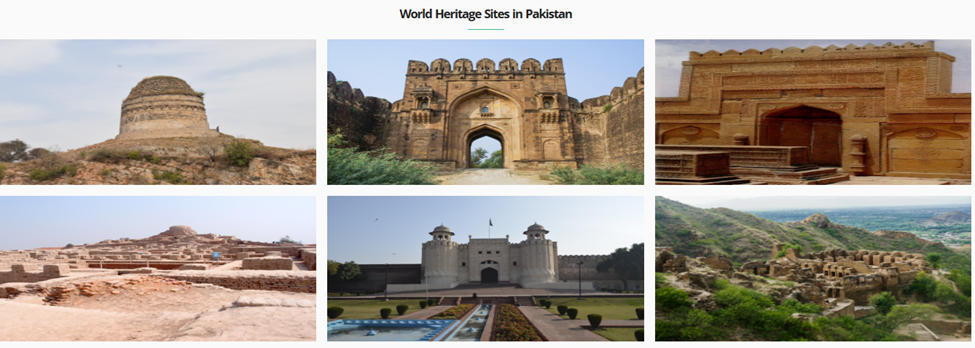
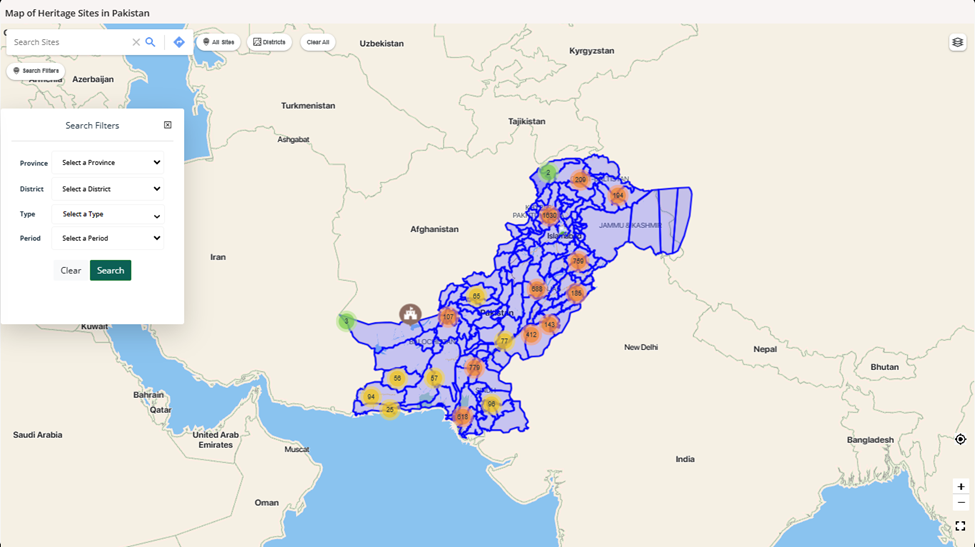
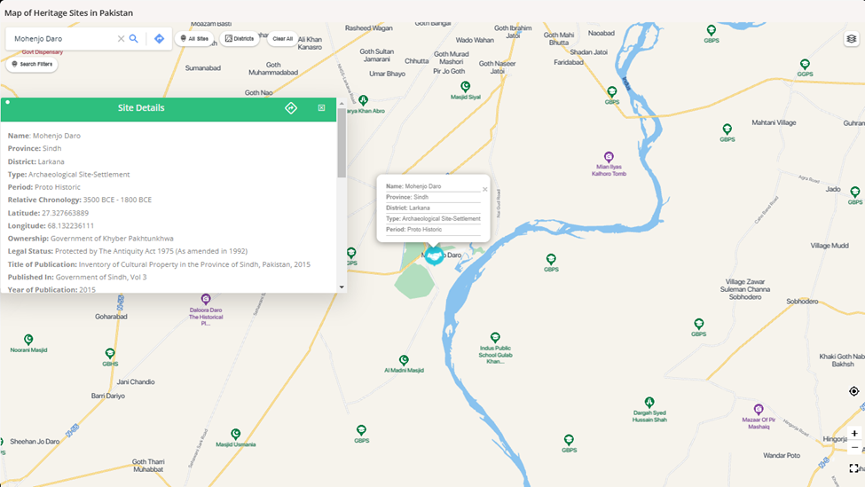
With more than 6,000 heritage sites, Pakistan is a country rich in cultural, historical, and archaeological landmarks such as Mohenjo-Daro, Taxila, and the Lahore Fort.
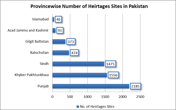
Mapping heritage sites in Pakistan accurately using GIS can facilitate better management, protection, and promotion of the nation’s heritage. It enables authorities to monitor changes in site conditions, assess vulnerabilities to natural and anthropogenic threats like urban expansion or climate impacts, and plan conservation measures effectively. Therefore, Department of Archaeology and Museums, Government of Pakistan has launched and published an online map of the significant heritage sties across all the provinces of Pakistan.
The user can apply filters of Province, district, type and period as well as search the complete heritage sites repository on basis of the site name. On a single click, the user can get detailed information about the site including name, province, district, geographic coordinates, period, relative chronology, description, legal status, year of publication, and bibliographic reference etc.
GIS also allows integration of visitor data to analyze seasonal trends in tourism, identifying peak and low visitation periods. The presently available visitor record at archeological museums in Pakistan during January to December from 2015 to 2021, published by Pakistan Bureau of Statistics, Government of Pakistan can be geotagged and analyzed. This would help in optimizing visitor management, ensuring that infrastructure and resources are aligned with demand, and enhancing the visitor experience while mitigating over-tourism risks. By leveraging GIS for such purposes, Pakistan can preserve its heritage for future generations while promoting sustainable tourism.
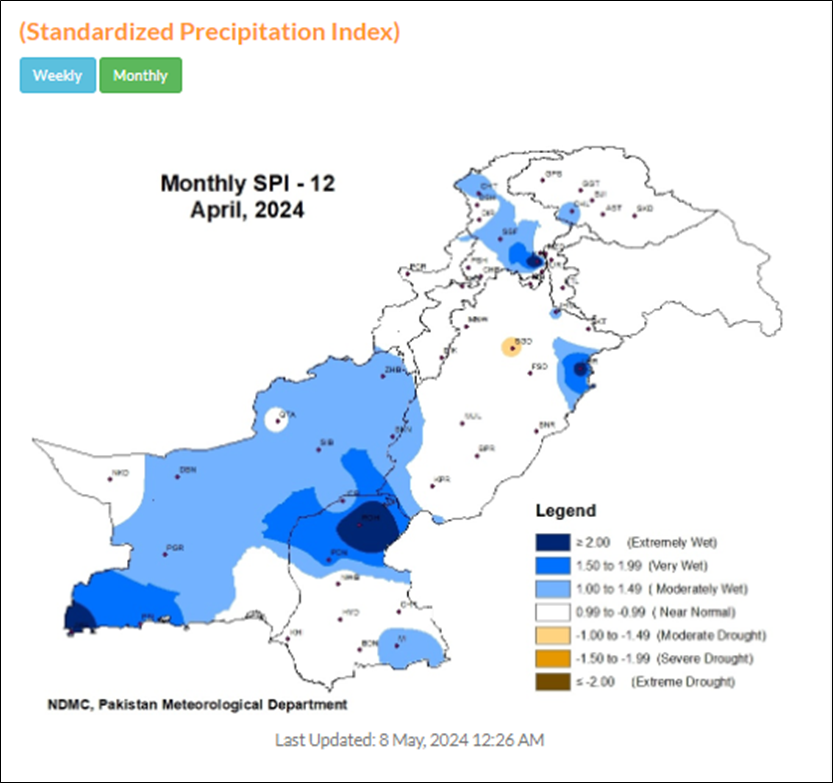
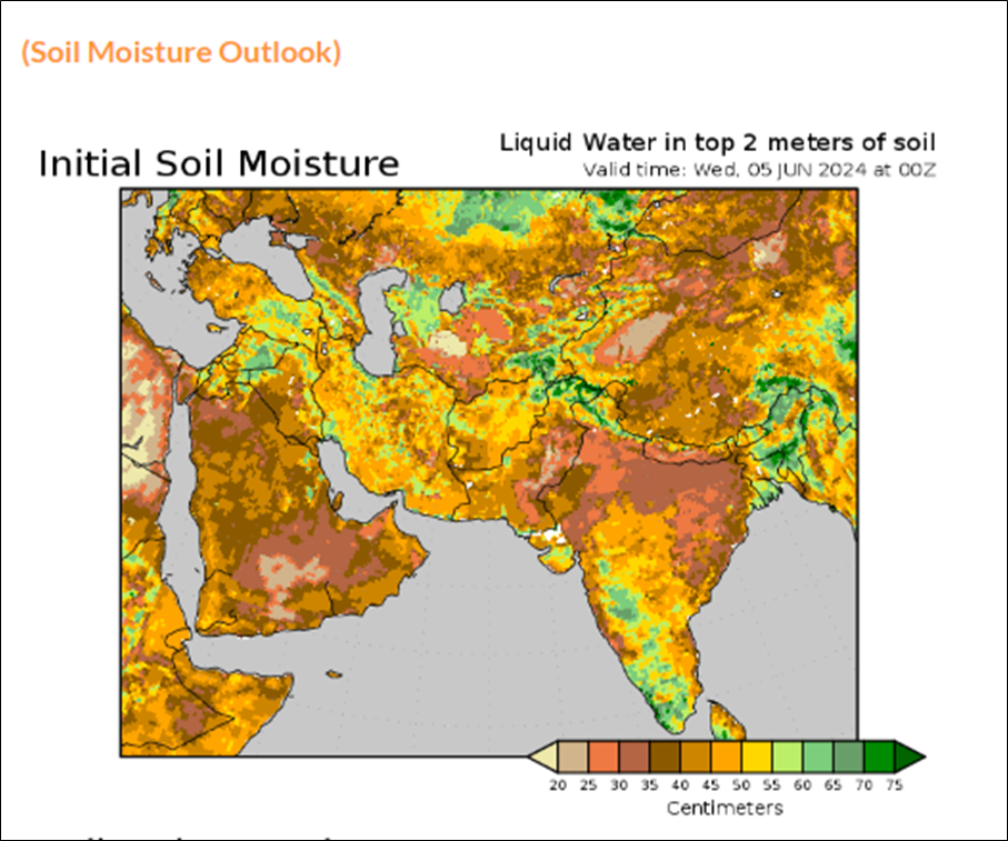
National Drought Monitoring Centre (NDMC), Islamabad is serving the nation as a hub for the collection, consolidation and analysis of drought related data from all possible sources in the country; preparing and disseminating monthly drought bulletins & moisture stresses based on various indices; advising government agencies on drought related matters including drought declaration, and conducting research on drought related issues and development of statistical models for improved drought prediction.
Drought Watch corner displays outlook maps and graphs on following important parameters, at national and regional level as appropriate:
Drought Monitor
Precipitation
Standardized Precipitation Index
Soil Moisture Outlook
Rain Percentage Anomaly Change
Percentage Departure Of Rainfall
Cumulative Precipitation Anomaly
Soil Moisture Anomaly
Water Availability Forecast
Rainfall Analysis
Length Of Dry Period
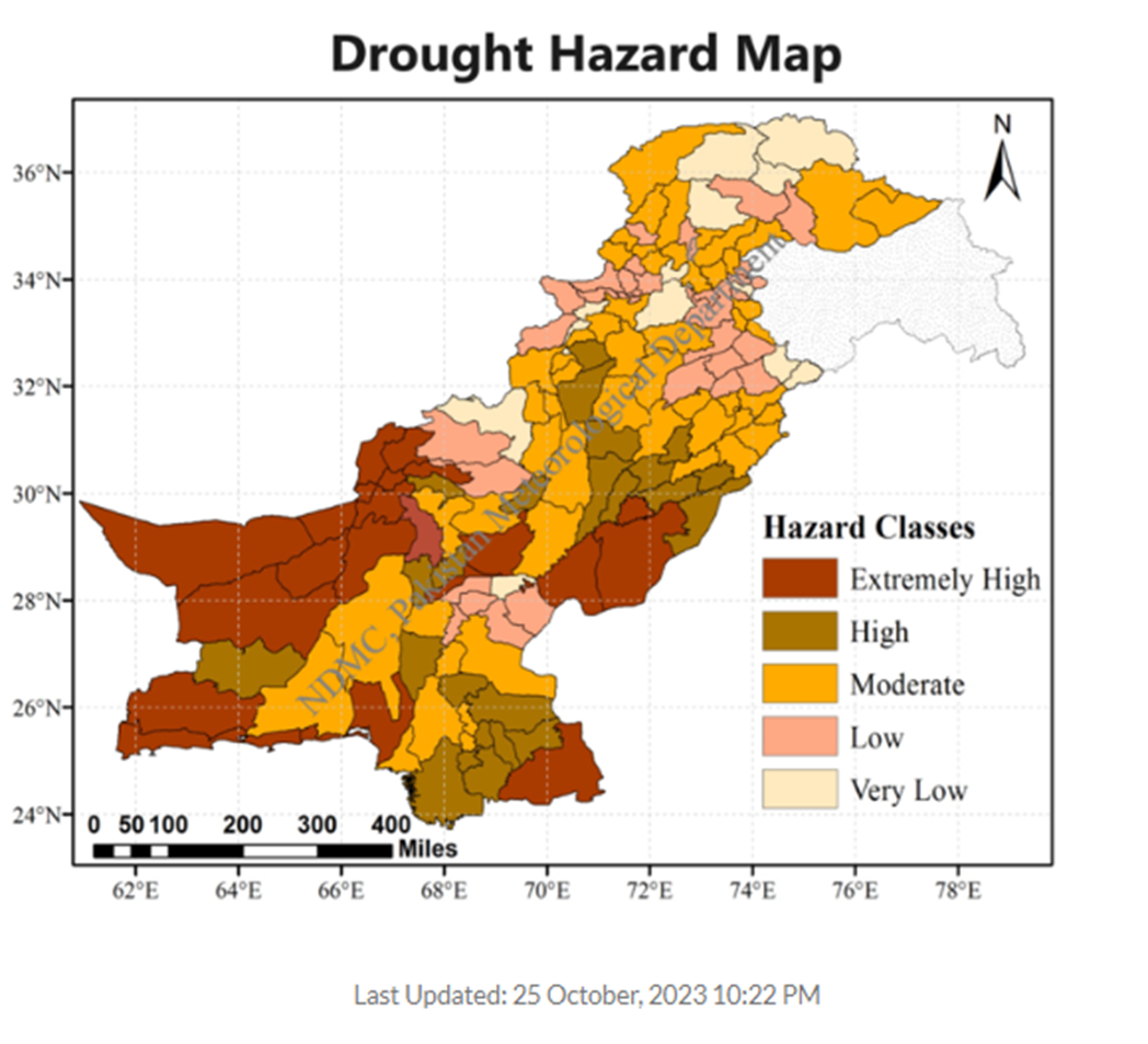
Drought Hazard Map
Drought Frequency Map
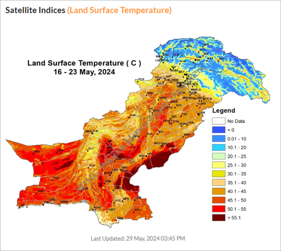
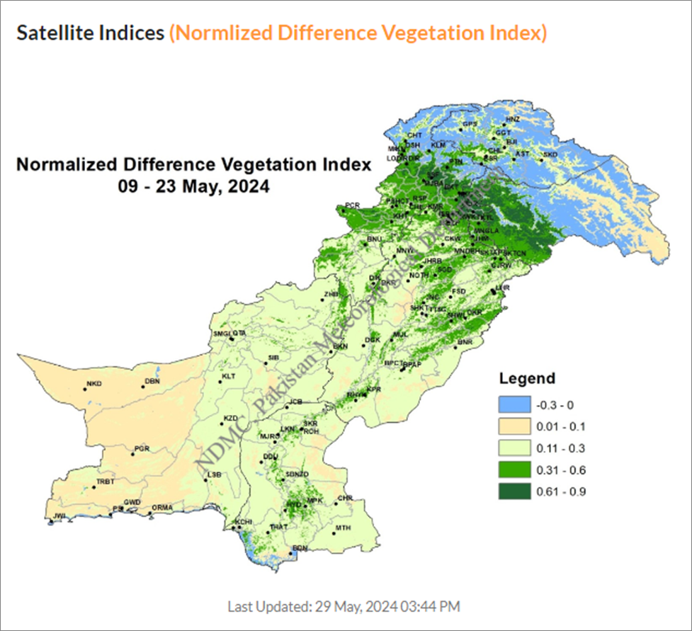
Few of these data products are being illustrated here:
NDMC leverages Land surface temperature (°C), Normalized Difference Vegetation Index: NDVI) and Temperature Vegetation Dryness Index as powerful satellite driven indices for monitoring Earth’s surface, overcoming limitations associated with traditional weather station data. These indices enhance understanding of environmental processes and improve resilience. The estimates are made available on NDMC website link: https://ndmc.pmd.gov.pk/new/satellite-indices.php
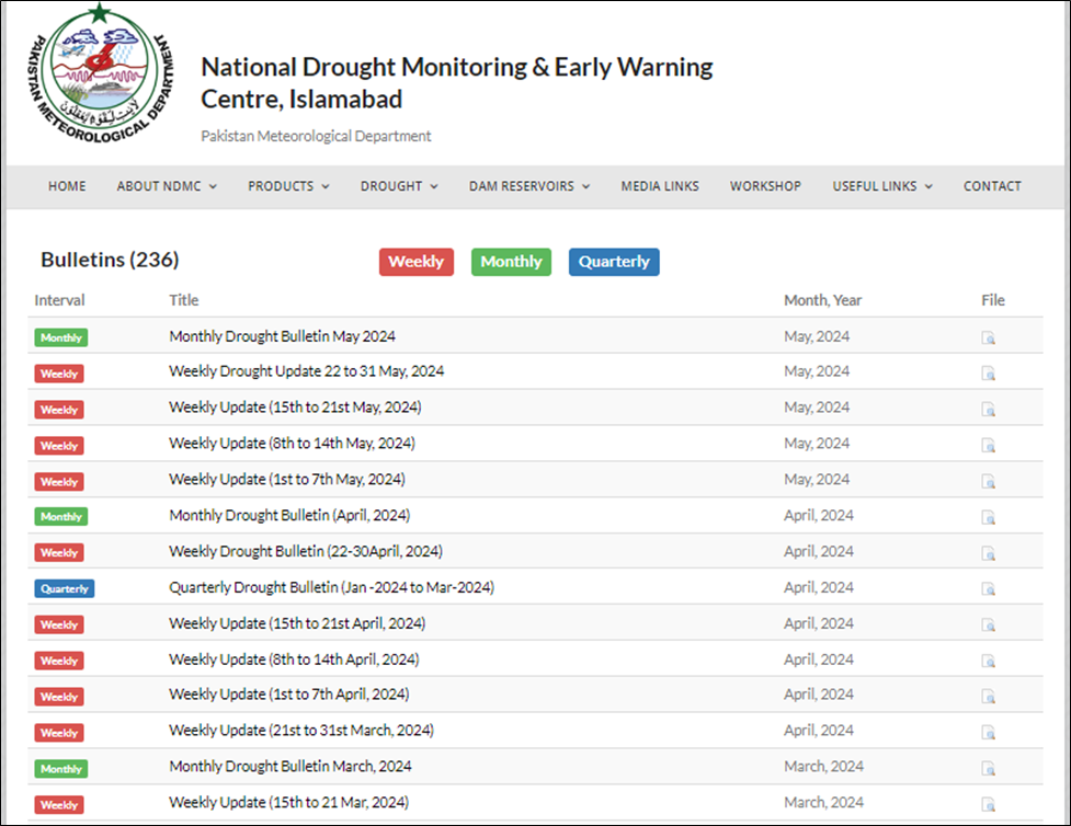
The availability of weekly, monthly, and quarterly drought bulletins issued by the NDMC is also a valuable resource for monitoring and managing drought conditions. These bulletins provide essential information to stakeholders, policymakers, and the public. By offering insights into drought severity, trends, and potential impacts, they contribute to informed decision-making and preparedness efforts. Once you locate the bulletins, you can download them in pdf format.
As we commemorate World Environment Day 2024 with the theme Land restoration, desertification and drought resilience; it is important to acknowledge the existence and contribution of NDMC Pakistan. However, it is suggested to enhance the outreach of multiple drought related products. It is envisaged that provision of spatio-temporal map products and their statistics in user friendly formats (like *.csv, *.jason, *.geotiff, *.shp etc.) is vital. It would help students and researchers to easily integrate diverse interrelated and interdependent geospatial datasets; develop dynamic data driven products and models, holistic drought monitoring and hazard assessment tools, and drought resilience index calculator etc. at local, national, regional and global scales.
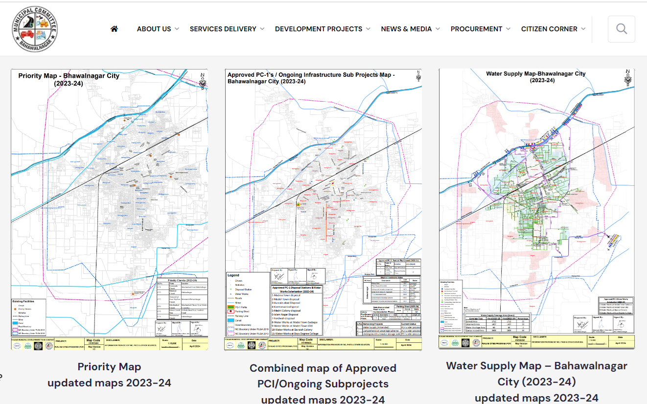
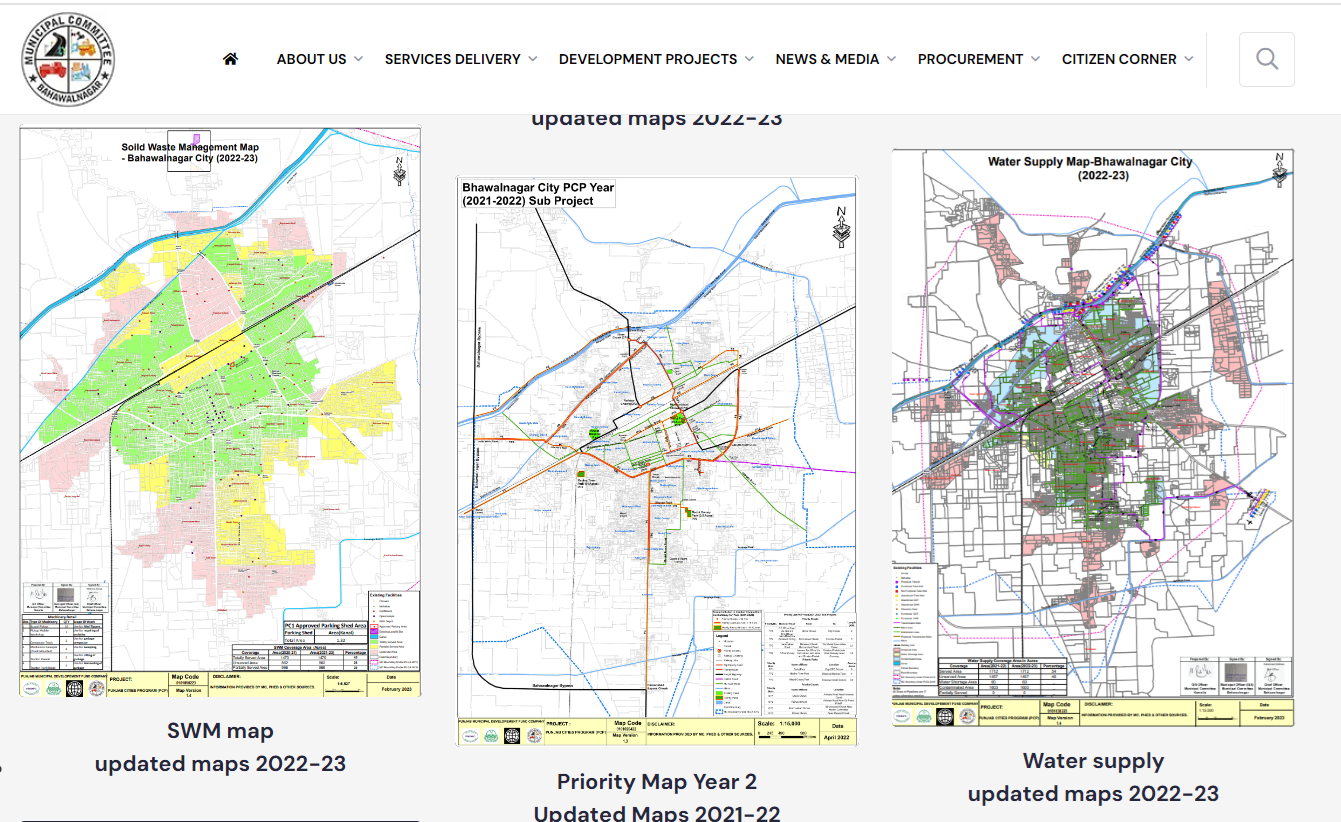
GIS Municipal Services Maps serve as powerful tools for enhancing the effectiveness, efficiency, and sustainability of urban governance and service delivery. They enable evidence-based decision-making, promote civic engagement, and contribute to the overall quality of life in cities and municipalities.
With this realization, Punjab Municipal Development Fund Company (PMDFC), Government of Punjab has harnessed GIS technology to meet their goal “Help Build Healthy Cities”. The GIS-based service maps are regularly developed and disseminated under the Punjab Cities Program (PCP) to support planning officers of 16 municipal corporations/committees within Punjab province namely: Bahawalnagar, Burewala, Daska, Gojra, Hafizabad, Jaranwala, Jhang, Jhelum, Kamalia, Kamoke, Khanewal, KotAddu, Muridke, Okara, Vehari and Wazirabad. Here are few screenshots of the original website:
To date GIS thematic maps including base map, roads and chowks; solid waste management; sewerage; street lights; parks, water supply, approved schemes of these targeted MCs are available online for time period 2023-2024, 2022-2023 and 2021-2022 in pdf format (Source: https://pmdfc.punjab.gov.pk/gis-map-16_cities-pcp).
It is noteworthy that Local Government & Community Development (LG & CD) Department also has representation in Board of Directors (BoDs) of PMDFC.
It’s great to have these detailed maps that cover such diverse thematic nature from connectivity to water works to solid waste management to approved future developments etc. within municipality. However, it would be great if such donor funded projects make the GIS data available in open domain to support researchers and stakeholders. In some cases, there is a significant need to improve the cartographic and vector data quality. PakistanGIS user may use the data as provided. These maps will be available at http://geonode.pakistangis.org/ as well.