
GIS Municipal Services Maps serve as powerful tools for enhancing the effectiveness, efficiency, and sustainability of urban governance and service delivery. They enable evidence-based decision-making, promote civic engagement, and contribute to the overall quality of life in cities and municipalities.
With this realization, Punjab Municipal Development Fund Company (PMDFC), Government of Punjab has harnessed GIS technology to meet their goal “Help Build Healthy Cities”. The GIS-based service maps are regularly developed and disseminated under the Punjab Cities Program (PCP) to support planning officers of 16 municipal corporations/committees within Punjab province namely: Bahawalnagar, Burewala, Daska, Gojra, Hafizabad, Jaranwala, Jhang, Jhelum, Kamalia, Kamoke, Khanewal, KotAddu, Muridke, Okara, Vehari and Wazirabad. Here are few screenshots of the original website:
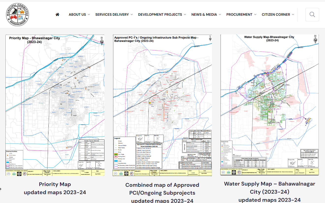
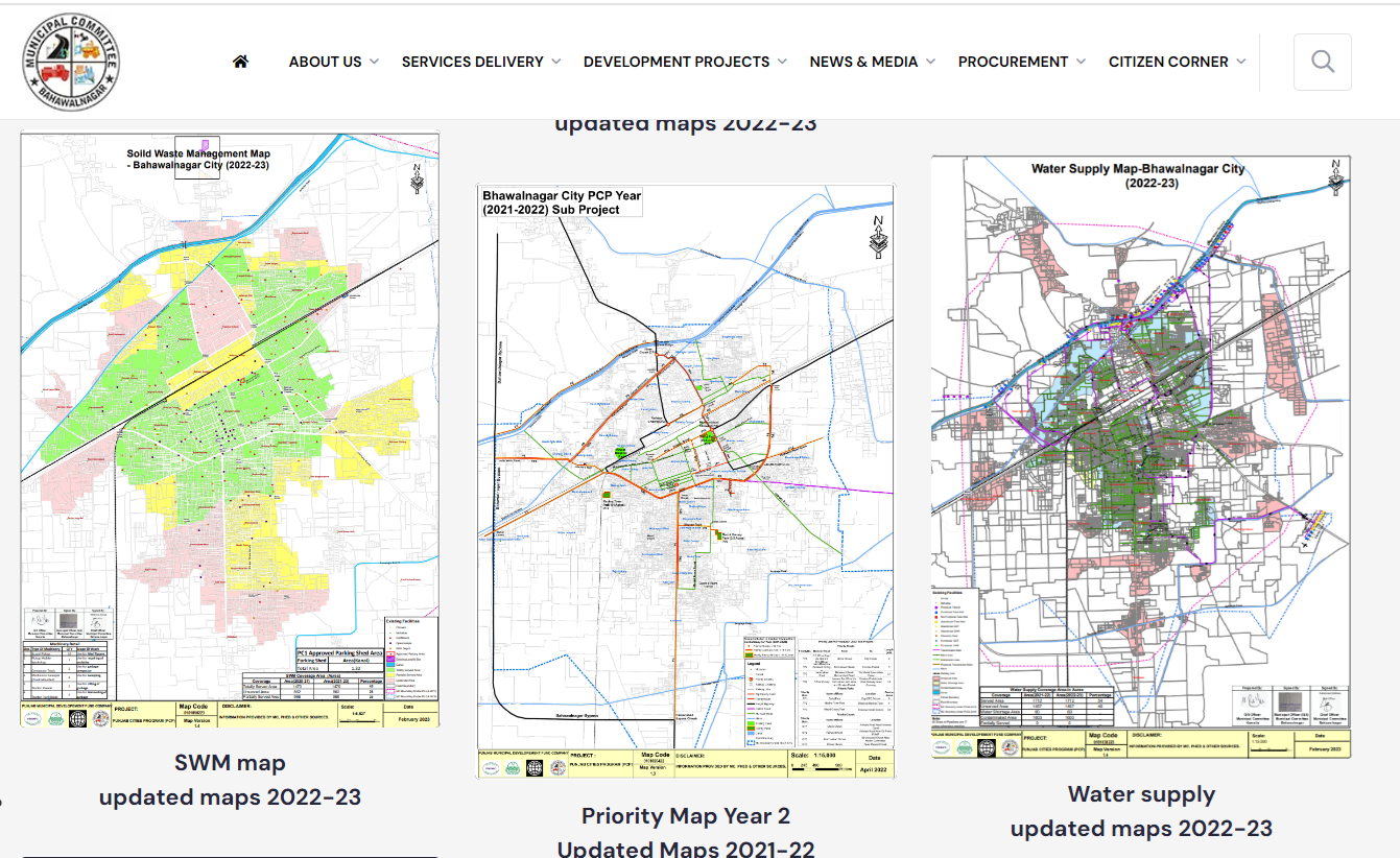
To date GIS thematic maps including base map, roads and chowks; solid waste management; sewerage; street lights; parks, water supply, approved schemes of these targeted MCs are available online for time period 2023-2024, 2022-2023 and 2021-2022 in pdf format (Source: https://pmdfc.punjab.gov.pk/gis-map-16_cities-pcp).
It is noteworthy that Local Government & Community Development (LG & CD) Department also has representation in Board of Directors (BoDs) of PMDFC.
It’s great to have these detailed maps that cover such diverse thematic nature from connectivity to water works to solid waste management to approved future developments etc. within municipality. However, it would be great if such donor funded projects make the GIS data available in open domain to support researchers and stakeholders. In some cases, there is a significant need to improve the cartographic and vector data quality. PakistanGIS user may use the data as provided. These maps will be available at http://geonode.pakistangis.org/ as well.


