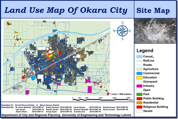
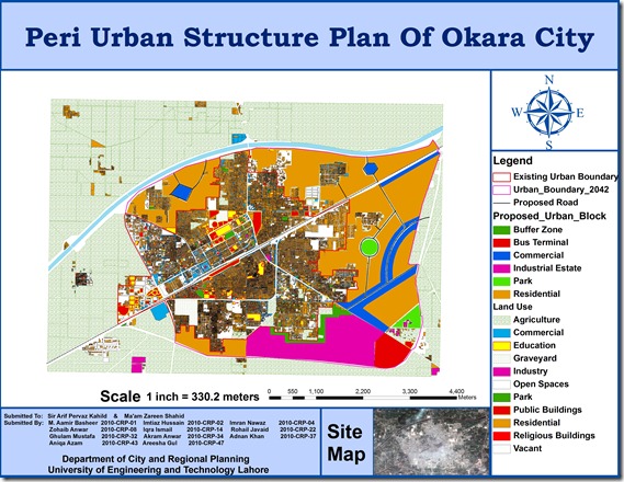
A group of urban planning students from University of Engineering and Technology (CRP-10) including M. Aamir Basheer, Imtiaz Hussain, Imran Nawaz, Zohaib Anwar, Iqra Ismail, Rohail Javaid, Ghulam Mustafa, Akram Anwar, Adnan Khan, Aniqa Azam, Areesha Gul has prepared GIS based peri urban structure plan of Okara City using high resolution satellite image. The map includes Points of interest , Existing urban boundary , Existing land uses, Proposed Roads, and Proposed urban block.
This is a true addition to the existing effort on GIS mapping of Okara which was done by Munawar and Nausheen (CRP-08) in 2009. Previous map can be seen HERE.


