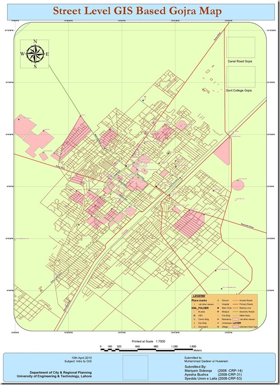
Gojra (Punjabi, Urdu: گوجرہ), the capital of Gojra Tehsil, is a city of Toba Tek Singh District in the Punjab province of Pakistan,[1] it is located at 31°9’N 72°41’E[2] and is located 30 miles (50 km) from Faisalabad, 125 km from Burewala, 157 km from Vehari and 20 miles (32 km) north of Toba Tek Singh.[3] It has a history of more than hundred years, and being the centre of the cultivated lands, the village was famous for its “Mandi” (market) for cash crops. Before the 1947 Partition of India that created Pakistan the “Mandi” was mainly handled by Hindus and Sikhs. Read More>>
This map has been been prepared by Mariyam, Aysha and Syedda Umme Laila. They are Urban Planners from Department of City & Regional Planning, University of Engineering & Technology, Lahore.
Methodology Adopted:
Street level mapping has been completed using high resolution images (0.6-1m) of Google Earth dating May 20, 2009 within a period of two months. Detailed process is mentioned in the tutorial HERE.
Contents:
- Data Layers:
- Primary Roads
- Secondary Roads
- Tertiary Roads/ Streets
- Water Bodies
- Railway Lines
- Points of Interest (Hospitals, Educational Buildings, Public Buildings, Mosques, Hotels, Banks, Petrol Pumps etc)
-
Area features (Parks, open spaces, Built up areas, Graveyards, Housing Schemes, water bodies etc)
2. Coverage:
- 46.58 Square Kilometer
Availability:
Data is available in KML and ESRI Shape file formats.

