PKMAPS is a small community of mapping enthusiasts (all over the world) choosing to map Pakistan and share data for free on the internet. They develop maps for GPS or navigators for providing aid in navigation across the Pakistan.
Here, we are using their gps maps to prepare ESRI format shape files, that can be used in GIS software like ArcGIS and Arcview for various analysis and applications for urban planning. Hence expanding the area of application for those maps.
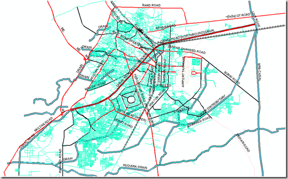
We are presenting a map of Lahore city containing line, point and polygonal features. Coverage and Road hierarchy is visible even from the picture below.
Points Shape File:
About 1082 places of interest are identified and categories as Hospitals, banks, graveyards, libraries, parks, schools, restaurants, shopping centers, stadiums, amusement centers, landmarks and swimming areas etc.
Lines Shape File:
This layer includes 8418 line features which represent arterial roads, collector roads, residential streets, major highways, alleys, railway routes, airport runways, and water streams. 643 features are identified with their names as well.
Polygones Shape File:
This map layer carries 754 polygones showing city parks, lakes, orchards or plantations, housing schemes or institution boundaries and other polygonal features.Location names are updated for 690 features.
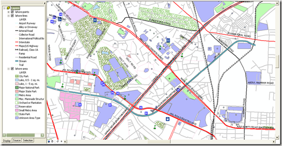
Screen shot below shows a zoom in view where all points, lines and polygonal features can be seen with the level of detail. 
.::Special thanks to PKMAPS, smkhan and Faisal::.
