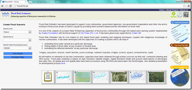
Flood Risk Estimator has been developed to support rural communities, government agencies, non-government organization and other line actors working in flood prone areas of District Layyah by providing them scenario based precise information on flood risks.
It is one of the outputs of a project titled ‘Enhancing capacities of flood prone communities through GIS based early warning system’ implemented by Doaba Foundation with technical support of City Pulse (Pvt.) Ltd. It has been generously supported by Oxfam GB.
Flood Risk Estimator has its core based on GIS based flood plain modeling and mapping techniques coupled with indigenous knowledge of riverine communities. It has been developed with the objectives of creating a system which can help in:
- estimating flood water spread at a particular discharge
- finding depth of flood water at any location in flooded area
- estimating the affected elements* at any particular discharge
*villages, population, schools, health facilities, public buildings, livestock hospitals, bridges, culverts, sippers, embankments, roads
All information on elements at risk and communities’ capacities have been obtained through primary sources via field visit, community meeting and GPS survey. Flood plain modeling is based on high resolution satellite images, Digital Elevation Model and ground observations of discharges and water flow. All spatial and non spatial data have been processed using HECRAS and associated GIS technologies. See detailed presentation on development process here.
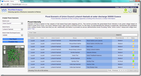
A snapshot of Flood Scenario Report generated for one Union council
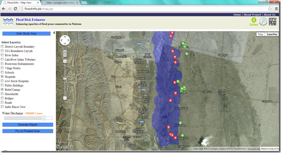
A snapshot of Flood Plain Mapping and Elements at Risk
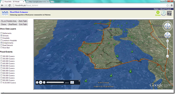
A snapshot of Fly on Flooded Area


