Satellite Image Pakistan Flood 15 August 2010

Relying on NASA Earth Observatory on Natural Hazards, following image has been geo-referencing and converted to KML:

  1. 15 August 2010

The Moderate Resolution Imaging Spectroradiometer (MODIS) on NASA’sAqua satellite captured this image of Pakistan. This image uses a combination of infrared and visible light to increase the contrast between water and land. Water appears in varying shades of blue, vegetation is green, and bare ground is pinkish brown. Clouds are bright turquoise.

pakistan_amo_15 Aug 2010

                                     .::Click HERE to request for this data set::.

Satellite Image Pakistan Flood 30 July 2010

Relying on NASA Earth Observatory on Natural Hazards, following image has been geo-referencing and converted to KML:

  1. 30 July 2010

The Moderate Resolution Imaging Spectroradiometer (MODIS) on NASA’sAqua satellite captured this image of Pakistan. This image uses a combination of infrared and visible light to increase the contrast between water and land. Water appears in varying shades of blue, vegetation is green, and bare ground is pinkish brown. Clouds are bright turquoise.

pakistan_amo_30 July 2010_lrg

                                         .::Click HERE to request for this data set::.
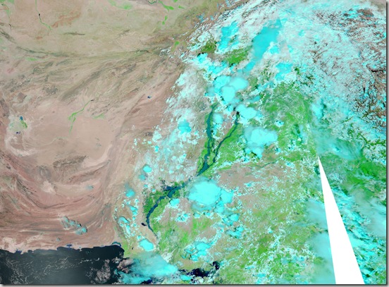
Satellite Image Pakistan Flood 17 August 2010

Relying on NASA Earth Observatory on Natural Hazards, following image has been geo-referencing and converted to KML:

  1. 17 August 2010

The Moderate Resolution Imaging Spectroradiometer (MODIS) on NASA’sAqua satellite captured this image of Pakistan. This image uses a combination of infrared and visible light to increase the contrast between water and land. Water appears in varying shades of blue, vegetation is green, and bare ground is pinkish brown. Clouds are bright turquoise.

pakistan_amo_17 Aug 2010_lrg

                                         .::Click HERE to request for this data set::.
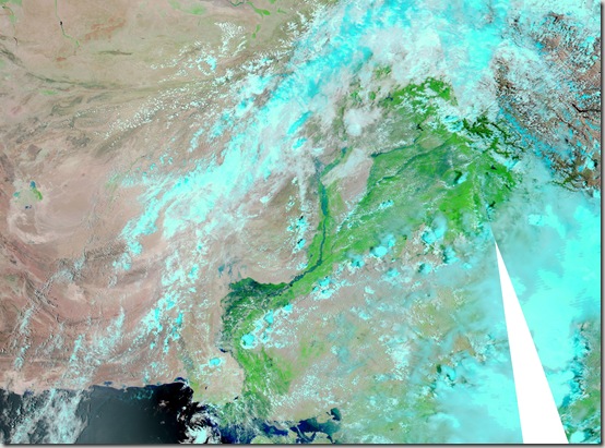
Satellite Image Pakistan Flood 02 September 2010

Relying on NASA Earth Observatory on Natural Hazards, following image has been geo-referencing and converted to KML:

  1. 02 September 2010

The Moderate Resolution Imaging Spectroradiometer (MODIS) on NASA’sAqua satellite captured this image of Pakistan. This image uses a combination of infrared and visible light to increase the contrast between water and land. Water appears in varying shades of blue, vegetation is green, and bare ground is pinkish brown. Clouds are bright turquoise.

pakistan_amo_02 Sep 2010

                                          .::Click HERE to request for this data set::.
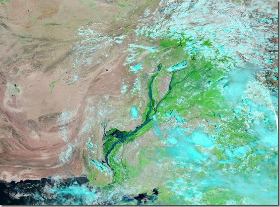
Satellite Image Pakistan Flood 29 August 2010

Relying on NASA Earth Observatory on Natural Hazards, following image has been geo-referencing and converted to KML:

  1. 29 August 2010

The Moderate Resolution Imaging Spectroradiometer (MODIS) on NASA’sAqua satellite captured this image of Pakistan. This image uses a combination of infrared and visible light to increase the contrast between water and land. Water appears in varying shades of blue, vegetation is green, and bare ground is pinkish brown. Clouds are bright turquoise.

pakistan_tmo_29 Aug 2010

                                          .::Click HERE to request for this data set::.
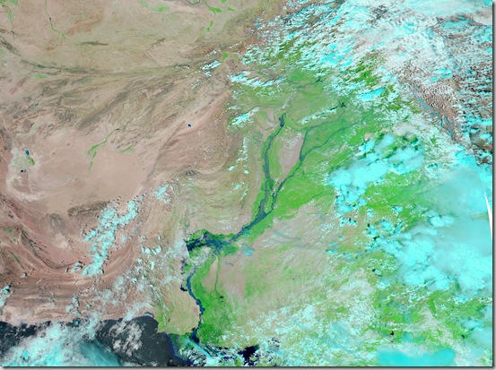
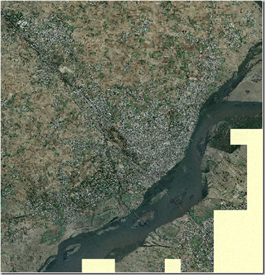
Satellite Image of Vehari

Here is the metadata of the satellite image of Vehari:

DESCRIPTION

vehari.ecw

WEST LONGITUDE

72° 18′ 58.5126" E

NORTH LATITUDE

30° 04′ 3.3672" N

EAST LONGITUDE

72° 23′ 32.4957" E

SOUTH LATITUDE

30° 00′ 53.8632" N

PROJ_DESC

Geographic (Latitude/Longitude) / WGS84 / arc degrees

PROJ_DATUM

WGS84

PROJ_UNITS

arc degrees

EPSG_CODE

4326

COVERED AREA

16.58 sq mi

NUM COLUMNS

11335

NUM ROWS

7840

NUM_BANDS

3

PIXEL WIDTH

0.0000067 arc degrees

PIXEL HEIGHT

0.0000067 arc degrees

BIT_DEPTH

24

PROJ_NAME

GEODETIC

DATUM_NAME

WGS84

TARGET_COMPRESSION

1:10

Screen Shot of the Image:image

                                  .::Click HERE to request for this data set::.
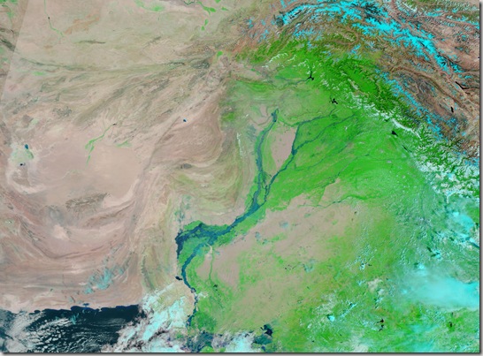
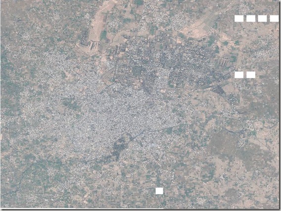
Satellite Image of Liaqatpur (Rahim yar Khan)

Liaquatpur or Liaqatpur is a town and seat of Liaquatpur Tehsil in Rahim Yar Khan District, Pakistan. It is located at 28°55’60N 70°57’0E with an altitude of 95 metres (314 feet).[1]

It is situated exactly between the main cities of Bahawalpur and Rahim Yar Khan. The main railway line connecting Lahore and Karachi passes through this city and a small railway station is also in this city.  (Wikipedia)

Metadata of the satellite image is given below:

DESCRIPTION

Liaqatpur19.ecw

WEST LONGITUDE

70° 55′ 48.2465" E

NORTH LATITUDE

28° 57′ 7.0591" N

EAST LONGITUDE

70° 58′ 9.9187" E

SOUTH LATITUDE

28° 54′ 55.9313" N

PROJ_DESC

Geographic (Latitude/Longitude) / WGS84 / arc degrees

PROJ_DATUM

WGS84

PROJ_UNITS

arc degrees

EPSG_CODE

4326

COVERED AREA

6 sq mi

NUM COLUMNS

7336

NUM ROWS

6790

NUM_BANDS

3

PIXEL WIDTH

0.0000054 arc degrees

PIXEL HEIGHT

0.0000054 arc degrees

BIT_DEPTH

24

PROJ_NAME

GEODETIC

DATUM_NAME

WGS84

TARGET_COMPRESSION

1:10

Screen Shot of Image:

clip_image002[4]

                                      .::Click HERE to request for this data set::.
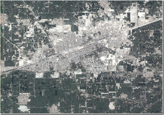
Satellite Image of Jhelum City

Below is the metadata of the image of Jhelum city available here:

DESCRIPTION

Jhelum19.ecw

Image Date

June 2009

WEST LONGITUDE

73° 40′ 5.3124" E

NORTH LATITUDE

32° 59′ 55.0067" N

EAST LONGITUDE

73° 46′ 13.3587" E

SOUTH LATITUDE

32° 53′ 24.5972" N

PROJ_DESC

Geographic (Latitude/Longitude) / WGS84 / arc degrees

PROJ_DATUM

WGS84

PROJ_UNITS

arc degrees

EPSG_CODE

4326

COVERED AREA

44.47 sq mi

NUM COLUMNS

19058

NUM ROWS

20216

NUM_BANDS

3

PIXEL WIDTH

0.0000054 arc degrees

PIXEL HEIGHT

0.0000054 arc degrees

BIT_DEPTH

24

PROJ_NAME

GEODETIC

DATUM_NAME

WGS84

TARGET_COMPRESSION

1:29

Screen Shot of Image:image

                           .::Click HERE to request for this data set::.

Satellite Image of Lahore

Satellite image of Lahore at good resolution is available at PKMaps. These can be used for any GIS/RS assignment and analysis.

Source of quoted material: http://pkmaps.freeforums.org/lahore-satellite-imagery-at-18x-zoom-t31.html

You can find all the Yahoo imagery you need for mapping Lahore at 18x zoom level at the following RapidShare download link:

http://rapidshare.com/files/176314336/lahore_yahoo_satalite_1.zip
http://rapidshare.com/files/176316142/lahore_yahoo_satalite_2.zip
http://rapidshare.com/files/176317579/lahore_yahoo_satalite_3.zip
http://rapidshare.com/files/176320007/lahore_yahoo_satalite_4.zip
http://rapidshare.com/files/176322298/lahore_yahoo_satalite_5.zip
http://rapidshare.com/files/176321238/lahore_yahoo_satalite_6.zip
http://rapidshare.com/files/176324063/lahore_yahoo_satalite_7.zip
http://rapidshare.com/files/176325590/lahore_yahoo_satalite_8.zip
http://rapidshare.com/files/176324388/lahore_yahoo_satalite_9.zip

These zips contain the Ozi Explorer .map files and embeded merged images in jpeg format.
They have been downloaded from Yahoo using gMapMaker.
There are 9 files in total so that Lahore can be split up into 9 portions.
You can use these Ozi map files along with their image files in GPSMapEdit for your mapping.
Depending on where you unzip the file contects you may need to edit with a text editor the .jpg file path on 3rd line in each .map (Ozi Explorer file) to point to the right location of its associated .jpg file for the .map file to work.
The original jpeg tiles from Yahoo at 18x zoom downloaded by gMapMaker can be found at the following rapishare links:

http://rapidshare.com/files/176831705/yahoo_satallite_imagery_at_18x.part1.rar
http://rapidshare.com/files/176833586/yahoo_satallite_imagery_at_18x.part2.rar
http://rapidshare.com/files/176834619/yahoo_satallite_imagery_at_18x.part3.rar

PS: You will need to download all these .rar files and run winrar to extract them to one folder.
Mobile GMaps can users also benifit from these files.

Geo-referenced Satellite Image of Sialkot

Please find here the Geo-referenced Aerial Photograph of Sialkot.

http://rapidshare.com/files/231074969/Sialkot.part1.rar
http://rapidshare.com/files/231086179/Sialkot.part2.rar

You need to download both files Sialkot.part1.rar and Sialkot.part2.rar and then unzip to gather. It will give you JPEG gile of sialkot city area along with .gmw file. The GMW is global mapper workspace file just like ozi explorer. You can use Global Mapper for its conversion to any format as per your need.

Following are the Image Details:

Image Date

9 October 2005

COVERED AREA

196.4 sq km

Download Eye Altitude

533 meters at Google Earth

DESCRIPTION

Sialkot Final.jpg


UPPER LEFT X

74.4745205570

UPPER LEFT Y

32.5547334337

LOWER RIGHT X

74.6323095316

LOWER RIGHT Y

32.4354937786


WEST LONGITUDE

74° 28′ 28.2740″ E

NORTH LATITUDE

32° 33′ 17.0404″ N

EAST LONGITUDE

74° 37′ 56.3143″ E

SOUTH LATITUDE

32° 26′ 7.7776″ N


PROJ_DESC

Geographic (Latitude/Longitude) / WGS84 / arc degrees

PROJ_DATUM

WGS84

PROJ_UNITS

arc degrees

EPSG_CODE

4326

NUM COLUMNS

24595

NUM ROWS

22105

PIXEL WIDTH

0.0000064 arc degrees

PIXEL HEIGHT

0.0000054 arc degrees

sialkot1