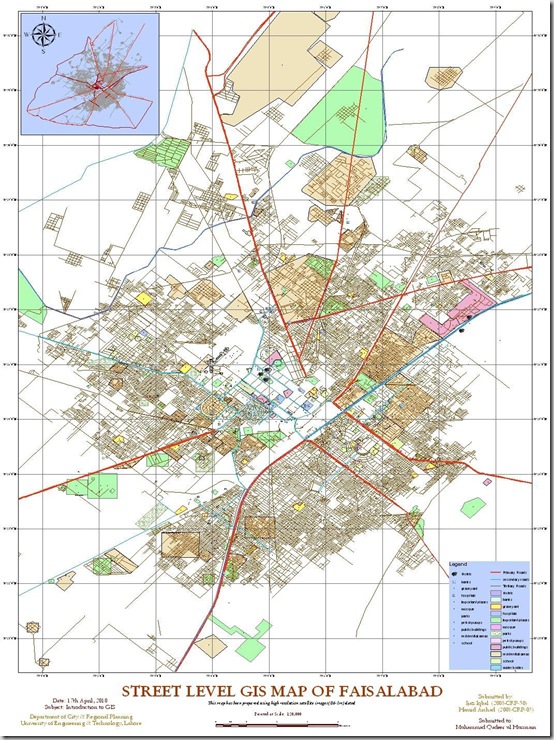
Street Level GIS Map of Faisalabad

Faisalabad (Punjabi, Urdu: فیصل آباد) is a city in the province of Punjab, Pakistan. It  is the third largest city in Pakistan after Karachi and Lahore.
It is an important industrial centre west of Lahore. The city-district of Faisalabad is bound on the north by the districts of Gujranwala and Sheikhupura, on the east by Sahiwal, on the south by Toba Tek Singh and on the west by Jhang. It is 1,135 km (705 mi) from Karachi, 128 km (80 mi) from Lahore, 350 km (220 mi) from Islamabad/Rawalpindi, 187 km (116 mi) from Burewala, and 70 km (43 mi) from Jhang. “Source: Wikipedia” Read More>>
This Street level GIS map has been been prepared by Hamid Arshad and Ijaz Iqbal. They are Urban Planners from Department of City & Regional Planning, University of Engineering & Technology, Lahore.

Methodology Adopted:

Street level mapping has been completed using high resolution images (0.6-1m) of  Google Earth dating December 25, 2005 within a period of two months. Detailed process is mentioned in the tutorial HERE.

Contents:
  1. Data Layers:
  • Primary Roads
  • Secondary Roads
  • Tertiary Roads/ Streets
  • Water Bodies
  • Railway Lines
  • Points of Interest (Hospitals, Educational Buildings, Public Buildings, Mosques, Hotels, Banks, Petrol Pumps etc)
  • Area features (Parks, open spaces, Built up areas, Graveyards, Housing Schemes, water bodies etc)

   2.    Coverage:

  • 717 Square Kilometer

Faisalabad1

Availability:

Data is available in KML and ESRI Shape file formats.

Get Data:
If you want to acquire this data, Use the Request Data Form to share your research and need of this data.

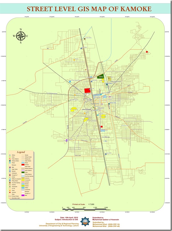
Street Level GIS Map of Kamoke, Muredkey

Kāmoke is a city of Gujranwala District located in Punjab, Pakistan, it has a population of 167,300[1]. The city is the capital of Kamoke Tehsil which is an administrative subdivision of the district, the city is itself subdivided into 8 Union Councils[2]. The city is located on the Grand Trunk Road 21 km towards Gujranwala and 44 km towards Lahore. Kamoke has become a popular city, all the needful things are found in the city. Reed More>>

This GIS map has been been prepared by Muhammad Afzal and Muhammad Bilal. They are Urban Planners from Department of City & Regional Planning, University of Engineering & Technology, Lahore.

Methodology Adopted:

Street level mapping has been completed using high resolution images (0.6-1m) of  Google Earth dating August 29, 2008 within a period of four weeks. Detailed process is mentioned in the tutorial HERE.

Contents:
  1. Data Layers:
  • Primary Roads
  • Secondary Roads
  • Tertiary Roads/ Streets
  • Water Bodies
  • Railway Lines
  • Points of Interest (Hospitals, Educational Buildings, Public Buildings, Mosques, Hotels, Banks, Petrol Pumps etc)
  • Area features (Parks, open spaces, Built up areas, Graveyards, Housing Schemes, water bodies etc)

   2.    Coverage:

  • 34 Square Kilometer

Kamoke

Availability:

Data is available in KML and ESRI Shape file formats.
Get Data:
Use the Request Data Form to share your research and need of this data to get it.

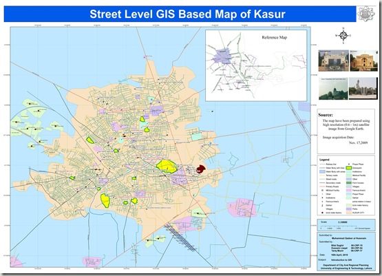
Street Level GIS Map of Kasur

This map has been been prepared by Bilal, Hussain and Tariq. They are Urban Planners from Department of City & Regional Planning, University of Engineering & Technology, Lahore.

Methodology Adopted:

Street level mapping has been completed using high resolution images (0.6-1m) from  Google Earth dating November 17, 2009 within a period of 4 weeks . Detailed process is mentioned in the tutorial HERE.

Contents:
  1. Data Layers:
  • Primary Roads
  • Secondary Roads
  • Tertiary Roads/ Streets
  • Water Bodies
  • Railway Lines
  • Points of Interest (Hospitals, Educational Buildings, Public Buildings, Mosques etc)
  • Area features (Parks, open spaces, Built up areas etc)

   2.    Coverage:

  • 1170 Square Kilometer

Kasur

Availability:

Data is available in KML and ESRI Shape file formats.
Get Data:

If you want to acquire this data, Use the Request Data Form to share your research and need of this data.

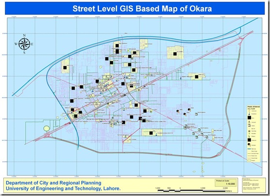
Street Level GIS Map of Okara

Okara Urdu: ( اوکاڑہ) is the capital city of Okara District in the Punjab province of Pakistan.[1] The city is located south-west to the city of Lahore and is famous for its agriculture-based economy and cotton mills. The nearest major city from Okara is Sahiwal (formerly known as Montgomery).
Okara has the largest storage capacity in Asia and is a fairly large district in Pakistan in terms of population. There are famous Pakistan military dairy farms, especially famous for their cheese situated in Okara. These farms are of the Pre-partition or British Indian Era. Mitchels farms also are located in the nearest town Renala Khurd in the Okara District. Read More>>
This street level GIS map has been been prepared by Nausheen and Munawar. They are Urban Planners from Department of City & Regional Planning, University of Engineering & Technology, Lahore.

Methodology Adopted:

Street level mapping has been completed using high resolution images (0.6-1m) of  Google Earth dating July 08, 2009. Detailed process is mentioned in the tutorial HERE.

Contents:
  1. Data Layers:
  • Primary Roads
  • Secondary Roads
  • Tertiary Roads/ Streets
  • Water Bodies
  • Railway Lines
  • Points of Interest (Hospitals, Educational Buildings, Public Buildings, Mosques, Hotels, Banks, Petrol Pumps etc)
  • Area features (Parks, open spaces, Built up areas, Graveyards, Housing Schemes, water bodies etc)

   2.    Coverage:

  • 45 Square Kilometer

Okara

Availability:

Data is available in KML and ESRI Shape file formats.
Get Data:
If you want to acquire this data, Use the Request Data Form to share your research and need of this data.

GIS Based Street Level Map of Multan

Multan (Punjabi/Urdu: مُلتان) is a city in the Punjab Province of Pakistan and capital of Multan District. It is located in the southern part of the province. Multan District has a population of over 4.5 million— It is situated on the east bank of the Chenab River, more or less in the geographic centre of the country and about 562 km (349 mi) from Islamabad,356 km (221 mi) from Lahore. & 966 km (600 mi) from Karachi. Source: Wikipedia Read More>>

This map has been been prepared by Askar Gardezi. He is a business man from Multan and a real enthusiastic mapper.

Methodology Adopted:

Street level mapping has been completed using high resolution images (0.6-1m) of  Google Earth dating March 20, 2009. Detailed process is mentioned in the tutorial HERE.

Contents:
  1. Data Layers:
  • Primary Roads
  • Secondary Roads
  • Tertiary Roads/ Streets
  • Water Bodies
  • Railway Lines
  • Points of Interest (Hospitals, Educational Buildings, Public Buildings, Mosques, Hotels, Banks, Petrol Pumps etc)
  • Area features (Parks, open spaces, Built up areas, Graveyards, Housing Schemes, water bodies etc)

   2.    Coverage:

  • 246.7 Square Kilometer

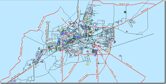
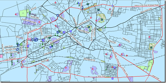
 imageimage

Availability:

Data is available in Polish Map format, KML and ESRI Shape file formats.

Get Data:

If you want to acquire this data, Use the Request Data Form to share your research and need of this data.

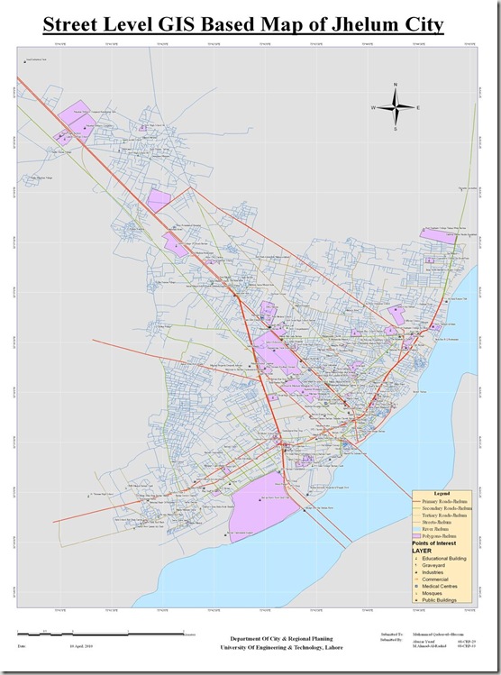
Street Level GIS Map of Jhelum

helum (Urdu,Punjabi: جہلم) is a city on the right bank of the Jhelum River, in the district of the same name in the north of Punjab province,Pakistan. Jhelum is a few miles upstream from the site of the Battle of the Hydaspes between the armies of Alexander the Great and RajaPorus. Jhelum is known for providing a large number of soldiers to the British and later to the Pakistan armed forces due to which it is also known as city of soldiersor land of martyrs and warriors. Read More>>
This map has been been prepared by Abuzar Yousaf and Ahmad Al Rashid. They are Urban Planners from Department of City & Regional Planning, University of Engineering & Technology, Lahore.

Methodology Adopted:

Street level mapping has been completed using high resolution images (0.6-1m) of  Google Earth dating June 22, 2009. Detailed process is mentioned in the tutorial HERE.

Contents:
  1. Data Layers:
  • Primary Roads
  • Secondary Roads
  • Tertiary Roads/ Streets
  • Water Bodies
  • Railway Lines
  • Points of Interest (Hospitals, Educational Buildings, Public Buildings, Mosques, Hotels, Banks, Petrol Pumps etc)
  • Area features (Parks, open spaces, Built up areas, Graveyards, Housing Schemes, water bodies etc)

   2.    Coverage:

  • 149.61 Square Kilometer

Jhelum

Availability:

Data is available in KML and ESRI Shape file formats.
Get Data:
If you want to acquire this data, Use the Request Data Form to share your research and need of this data.

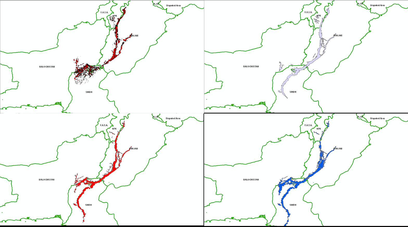
Pakistan Flood 2010, Water Extent from MODIS 12-29 Aug 2010

This geo-database is an effort of Mountain GeoPortal ICIMOD and includes the shapefiles of Water extent of 2010 flood in Pakistan. The flood water extent have been calculated from MODIS Images dating 12 August 2010 to 29 Aug 2010 on daily basis.

Pak Flood Extent 12-29 Aug 2010

                                          .::Click HERE to request for this data set::.

GIS Map of Bus Routes in Lahore

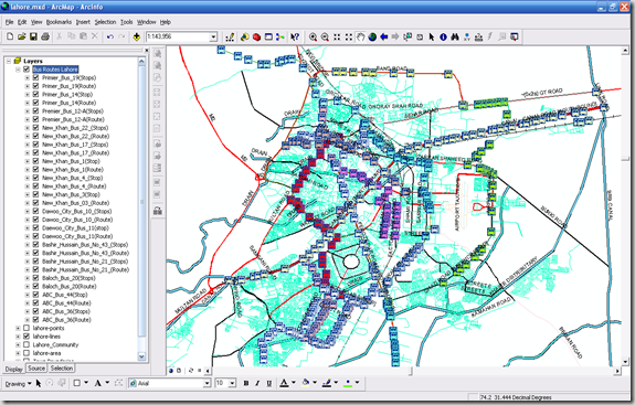
Mirza Muhammad Waqar form University of the Punjab is working on a project related to GIS mapping of various public transport routes in Lahore. He has generously shared his field data collected through primary surveys using GPS device. It includes the Bus Route Lines and Bus Stops Locations.

The GIS layers include the following routes:

  1. ABC Bus Route 36 (Chungi Amar Sadu to Daroghawala)
  2. ABC Bus Route 44 (Daroghawala to Old Ravi Pull)
  3. Baloch Bus Service Route 20 (Old Ravi Pull to Bagrian)
  4. Bashir Hussain Bus Route 21
  5. Bashir Hussain Bus Route 43
  6. Daewoo City Bus Route 11 (Green Town to Station)
  7. Green City Bus Route 10 (Railway Station to NFC Housing Scheme)
  8. New Khan Bus Route 3
  9. New Khan Bus Route 4
  10. New Khan Bus Route 1 (Sanda to RZ Bazar)
  11. New Khan Bus Route 17 (Railway Station to Jallo Pind)
  12. New Khan Bus Route 22 (Jallo Mor to Thokar Niaz Beig)
  13. Premier Bus Route 12-A (Railway Station to Yohanabad)
  14. Premier Bus Route 14 (RA Bazar to Bagrian)
  15. Premier Bus Route 19

image

Availability:

Data is available in ESRI Shape file formats.

Get Data:
If you want to acquire this data, Use the Request Data Form to share your research and need of this data.
 
Since this data belongs to Waqar, we will take his prior permission before disseminating this data set.

Topographic Maps of Pakistan

citypulseproudly presents the Geo-referenced Topographic Maps of whole Pakistan free of cost. These topo-sheets have been originally taken from the University of Texas Libraries in July 2009. These are developed by U.S. Army Map Service, 1955 under  Series U502 and are available at 1:250,000.
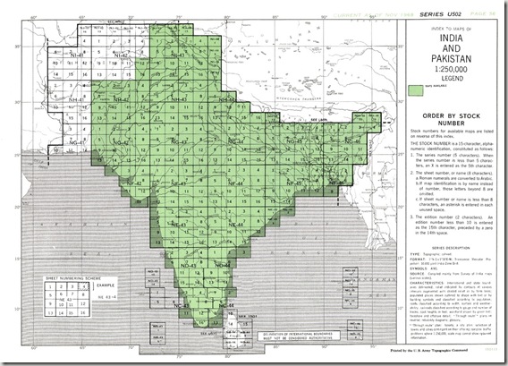
Below is a reference sheet taken from the above mentioned site.

Reference Sheet


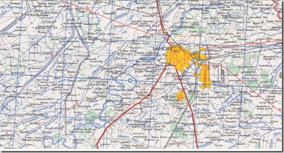
In University of Texas Libraries, these maps are available in .jpg picture format. A screen shot for area around Lahore is below:

topomap-lahore


The citypulse Team  have geo-referenced them and saved along with .gmw file to be viewed by Global Mapper. You may directly download from the library link or Contact Us for geo-referenced file.

Need your prayers

GIS Map of Lahore (ESRI format)

PKMAPS is a small community of mapping enthusiasts (all over the world) choosing to map Pakistan and share data for free on the internet. They develop maps for GPS or navigators for providing aid in navigation across the Pakistan.

Here, we are using their gps maps to prepare ESRI format shape files, that can be used in GIS software like ArcGIS and Arcview for various analysis and applications for urban planning. Hence expanding the area of application for those maps.

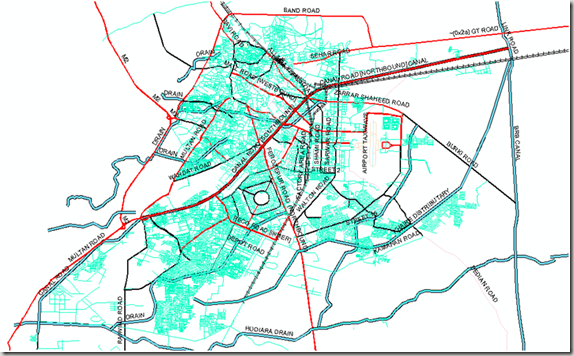
We are presenting a map of Lahore city containing line, point and polygonal features. Coverage and Road hierarchy is visible even from the picture below.image


Points Shape File:

About 1082 places of interest are identified and categories as Hospitals, banks, graveyards, libraries, parks, schools, restaurants, shopping centers, stadiums, amusement centers, landmarks and swimming areas etc.

Lines Shape File:

This layer includes 8418 line features which represent arterial roads, collector roads, residential streets, major highways, alleys, railway routes, airport runways, and water streams. 643 features are identified with their names as well.

Polygones Shape File:

This map layer carries 754 polygones showing city parks, lakes, orchards or plantations, housing schemes or institution boundaries and other polygonal features.Location names are updated for 690 features.

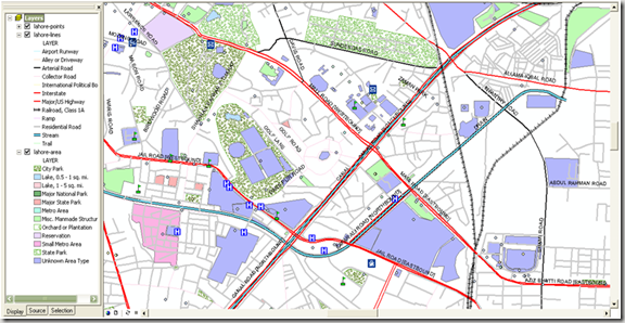
Screen shot below shows a zoom in view where all points, lines and polygonal features can be seen with the level of detail. image


                            .::Special thanks to PKMAPS, smkhan and Faisal::.