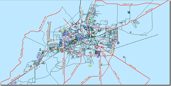
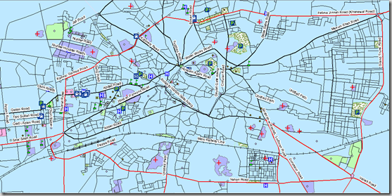
Multan (Punjabi/Urdu: مُلتان) is a city in the Punjab Province of Pakistan and capital of Multan District. It is located in the southern part of the province. Multan District has a population of over 4.5 million— It is situated on the east bank of the Chenab River, more or less in the geographic centre of the country and about 562 km (349 mi) from Islamabad,356 km (221 mi) from Lahore. & 966 km (600 mi) from Karachi. Source: Wikipedia Read More>>
This map has been been prepared by Askar Gardezi. He is a business man from Multan and a real enthusiastic mapper.
Methodology Adopted:
Street level mapping has been completed using high resolution images (0.6-1m) of Google Earth dating March 20, 2009. Detailed process is mentioned in the tutorial HERE.
Contents:
- Data Layers:
- Primary Roads
- Secondary Roads
- Tertiary Roads/ Streets
- Water Bodies
- Railway Lines
- Points of Interest (Hospitals, Educational Buildings, Public Buildings, Mosques, Hotels, Banks, Petrol Pumps etc)
-
Area features (Parks, open spaces, Built up areas, Graveyards, Housing Schemes, water bodies etc)
2. Coverage:
- 246.7 Square Kilometer
Availability:
Data is available in Polish Map format, KML and ESRI Shape file formats.
Get Data:
If you want to acquire this data, Use the Request Data Form to share your research and need of this data.


