Faisalabad (Punjabi, Urdu: فیصل آباد) is a city in the province of Punjab, Pakistan. It was formerly known as Lyallpur. Faisalabad is the third largest city in Pakistan after Karachi and Lahore. Before the foundation of the city in 1880, the area was very thinly populated. The population has risen from 9,171 in 1901 to 179,000 in 1951 and to 2,009,000 in 1998.[2] The larger Faisalabad district had a population of about 5.4 million in 1998.[3]
It is an important industrial centre west of Lahore. The city-district of Faisalabad is bound on the north by the districts of Gujranwala andSheikhupura, on the east by Sahiwal, on the south by Toba Tek Singh and on the west by Jhang. It is 1,135 km (705 mi) from Karachi, 128 km (80 mi) from Lahore, 350 km (220 mi) from Islamabad/Rawalpindi, 187 km (116 mi) from Burewala, and 70 km (43 mi) from Jhang.
The city is at a road and railway junction, which has played an influential role in the development of Faisalabad’s trade and economy. The surrounding countryside, irrigated by the Lower Chenab River, has seen expanded production of cotton, wheat, vegetables, and fruits, which form 25% of Pakistan’s exports. The city is also an industrial centre with major railway repair yards, engineering works, and mills thatprocess sugar, flour, and oil seed. Produce includes super phosphates, cotton and silk textiles, hosiery, dyes, agricultural equipment, andghee (clarified butter). Faisalabad is also the site of the prestigious University of Agriculture, founded in 1909.
Faisalabad is the largest industrial city of Pakistan and its textile capital, specialising in export-oriented manufactured goods.” Source: Wikipedia
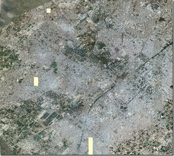
Here is the metadata for the available image. Complete Faisalabad urban area comes in three patches with us. Here is the first patch, rest are coming soon…
|
DESCRIPTION
|
Faisalabad.ecw
|
|
WEST LONGITUDE
|
73° 00′ 18.7521" E
|
|
NORTH LATITUDE
|
31° 28′ 51.3489" N
|
|
EAST LONGITUDE
|
73° 09′ 50.3459" E
|
|
SOUTH LATITUDE
|
31° 20′ 32.1941" N
|
|
PROJ_DESC
|
Geographic (Latitude/Longitude) / WGS84 / arc degrees
|
|
PROJ_DATUM
|
WGS84
|
|
PROJ_UNITS
|
arc degrees
|
|
EPSG_CODE
|
4326
|
|
COVERED AREA
|
89.81 sq mi
|
|
NUM COLUMNS
|
29598
|
|
NUM ROWS
|
25847
|
|
NUM_BANDS
|
3
|
|
PIXEL WIDTH
|
0.0000054 arc degrees
|
|
PIXEL HEIGHT
|
0.0000054 arc degrees
|
|
BIT_DEPTH
|
24
|
|
PROJ_NAME
|
GEODETIC
|
|
DATUM_NAME
|
WGS84
|
|
TARGET_COMPRESSION
|
1:10
|
Screen shot of the Image:

.::Click HERE to request for this data set::.
Like this:
Like Loading...


