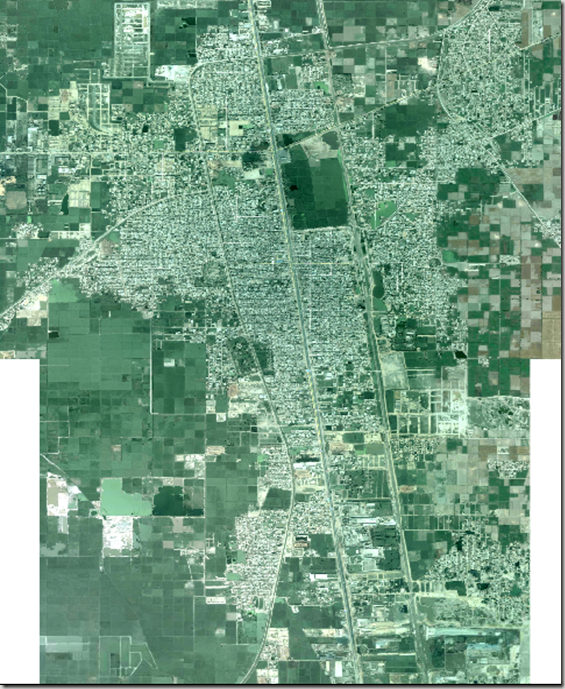
Please find here the high resolution Geo-referenced Aerial Photograph of Muredkey.
http://rapidshare.com/files/271703947/Muredkey_Satellite_Image.rar
Unzip after downloading. Folder will contain two .jpg with their calibration files for Global Mapper. You may adjust the image brightness using Photoshop but without disturbing the canvas size for a brighter image.
Below is the Metadata for the Image:
| IMAGE DATE | 29 August 2008 |
|
COVERED AREA |
4623 acres |
|
UPPER LEFT X |
74.2348172500 |
|
UPPER LEFT Y |
31.8199730000 |
|
LOWER RIGHT X |
74.2726319615 |
|
LOWER RIGHT Y |
31.7729982323 |
|
WEST LONGITUDE |
74° 14′ 5.3421″ E |
|
NORTH LATITUDE |
31° 49′ 11.9028″ N |
|
EAST LONGITUDE |
74° 16′ 21.4751″ E |
|
SOUTH LATITUDE |
31° 46′ 22.7936″ N |
|
PROJ_DESC |
Geographic (Latitude/Longitude) / WGS84 / arc degrees |
|
PROJ_DATUM |
WGS84 |
|
PROJ_UNITS |
arc degrees |
|
COVERED AREA |
4623 acres |
|
NUM COLUMNS |
8017 |
|
NUM ROWS |
9959 |
|
NUM_BANDS |
3 |
|
PIXEL WIDTH |
0.0000047 arc degrees |
|
PIXEL HEIGHT |
0.0000047 arc degrees |
|
PHOTOMETRIC |
RGB Full-Color |
|
BIT_DEPTH |
24 |
|
ROWS_PER_STRIP |
1 |
|
COMPRESSION |
None |
|
PIXEL_SCALE |
( 4.71682e-006, 4.71682e-006, 1 ) |
|
MODEL_TYPE |
Geographic lat-long system |
|
RASTER_TYPE |
Pixel is Area |
| SOURCE | GOOGLE EARTH |

